 Ireland · 12th century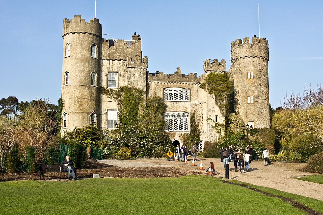
Malahide Castle (Irish: Caisleán Mhullach Íde), parts of which date to the 12th century, lies close to the village of Malahide, 14 km (nine miles) north of central Dublin in Ireland. It has over 267 acres (1.08 km2) of remaining parkland estate, forming the Malahide Demesne Regional Park.
The estate began in 1185, when Richard Talbot, a knight who accompanied Henry II to Ireland in 1174, was granted the "lands and harbour of Malahide." The oldest parts of the castle date back to the 12th century and it was home to the Talbot family for 791 years, from 1185 until 1976, the only exception being the period from 1649 to 1660, when Oliver Cromwell granted it to Miles Corbet after the Cromwellian conquest of Ireland; Corbet was hanged following the demise of Cromwell, and the castle was restored to the Talbots. The building was notably enlarged in the reign of Edward IV, with towers added in 1765.
The estate survived such losses as the Battle of the Boyne, when fourteen members of the owner's family sat down to breakfast in the Great Hall, and all were dead by evening, and the penal laws, even though the family remained Roman Catholic until 1774.
In 1918, during the First World War, a mooring-out base for airships was established in the grounds of the castle, used by airships from RNAS Anglesey in Wales which conducted anti-submarine operations in the Irish Sea. There were plans to base airships in the castle grounds from 1919, but they were abandoned at the end of the war.
In the 1920s, the private papers of James Boswell were discovered in the castle and sold to American collector Ralph H. Isham by Boswell's great-great-grandson Lord Talbot de Malahide. The papers have since passed to Yale University, which has published popular and scholarly editions of his journals and correspondence. Soon after, a second cache was discovered and also purchased by Isham.
Malahide Castle and its demesne was eventually inherited by the 7th Baron Talbot who had wanted to donate it to the state. On his death in 1973, the castle passed to his sister, Rose, who had lived there as a caretaker in the 1950s. She had death duties to pay, and the government would not accept valuables, so they had to be sold. In 1975, Rose ceded the castle to the Irish State, with regret, to fund the outstanding inheritance taxes.
Text adapted from “Malahide Castle” on Wikipedia, CC BY-SA 4.0.
Malahide Castle ranks #1,064 of 9,079 worldwide in the atlas's castle fame ranking, and #15 of the 178 mapped in Ireland. Founded 1185, it is older than 78% of the atlas's dated landmarks — one of 756 atlas entries founded in the 12th century. Its Wikipedia articles were opened 5,311 times in the last 60 days, more than 87% of the atlas. 18 more atlas landmarks stand within 25 km. The nearest day-trip guide is Dublin, 12 km away. See how Ireland compares in the castle statistics.
View on the interactive castle map →