Fortress
Mamucium
 England · 1st century
- Founded
- 79
- Location
- Manchester
- Coordinates
- 53.476°, -2.25089°
- Open data
- Wikidata Q3285089
- Links
- Wikimedia Commons
Description
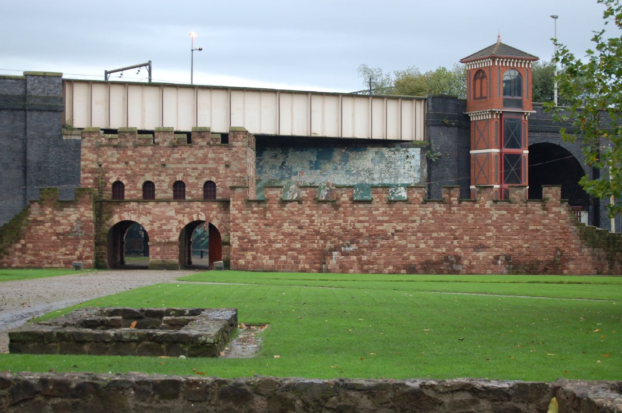
Mamucium, also known as Mancunium, is a former Roman fort in the Castlefield area of Manchester in North West England. The castrum, which was founded c. AD 79 within the province of Roman Britain, was garrisoned by a cohort of Roman auxiliaries near two major Roman roads running through the area. Several sizeable civilian settlements (or vicus) containing soldiers' families, merchants and industry developed outside the fort. The area is a protected Scheduled Ancient Monument.
The ruins were left undisturbed until Manchester expanded rapidly during the Industrial Revolution in the late 18th century. Most of the fort was levelled to make way for new developments such as the construction of the Rochdale Canal and the Great Northern Railway. The site is now part of the Castlefield Urban Heritage Park that includes renovated warehouses. A section of the fort's wall along with its gatehouse, granaries, and other ancillary buildings from the vicus have been reconstructed and are open to the public.
Text adapted from “Mamucium” on Wikipedia, CC BY-SA 4.0.
In the rankings
Mamucium ranks #2,191 of 9,902 worldwide in the atlas's castle fame ranking, and #167 of the 397 mapped in England. Founded 79, it is older than 98% of the atlas's dated landmarks, one of 34 atlas entries founded in the 1st century. Its Wikipedia articles were opened 3,142 times in the last 60 days, more than 82% of the atlas. 1 more atlas landmarks stand within 25 km. The nearest day-trip guide is Manchester, 2 km away. See how England compares in the castle statistics.
Castles nearby
- Buckton Castle16 km · England
- Dobroyd Castle28 km · England
- Halton Castle34 km · England
- Peveril Castle35 km · England
More castles in England
- Aldborough Roman SiteEngland · 1st century
- CoriaEngland
- Castle DrogoEngland · 20th century
- Scotney CastleEngland · 19th century