Fortress
Mannar Fort
🇱🇰 Sri Lanka · 16th century
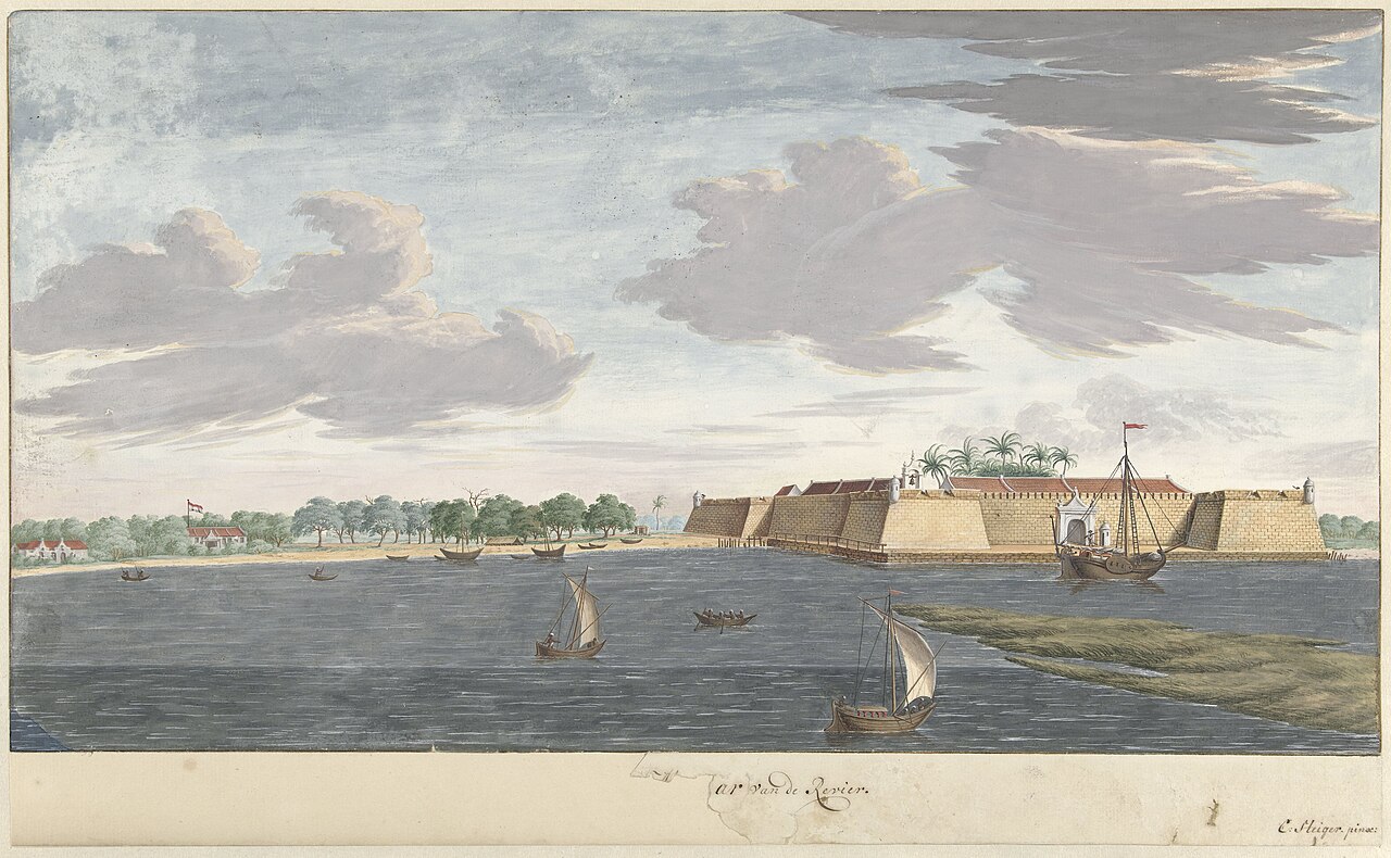
Mannar Fort (Tamil: மன்னார்க் கோட்டை, romanized: Maṉṉārk Kōṭṭai; Sinhala: මන්නාරම් බලකොටුව Mannaram Balakotuwa) is located on Mannar Island, Sri Lanka. It was built by Portuguese in 1560 and christened São Jorge. The fort fell to the Dutch in 1658, and they rebuilt the fort in 1696. In 1795 the British occupied the fort following the surrender by the Dutch.
It is a square-shaped fort with four bastions and is located next to the new bridge that connects the mainland with the Mannar Island.
The fort is currently occupied by the Department of Archeology.
Text adapted from “Mannar fort” on Wikipedia, CC BY-SA 4.0.
Mannar Fort ranks #5,929 of 8,134 worldwide in the atlas's castle fame ranking, and #11 of the 15 mapped in Sri Lanka. Founded 1560, it is older than 38% of the atlas's dated landmarks — one of 755 atlas entries founded in the 16th century. See how Sri Lanka compares in the castle statistics.
View on the interactive castle map →Frequently asked questions
Where is Mannar Fort?
Mannar Fort stands in Sri Lanka, at 8.97586°, 79.91701°.
When was Mannar Fort built?
The atlas dates its founding to 1560. Earlier structures may have stood on the site; this is the earliest documented founding year.
How famous is Mannar Fort?
In this atlas's fame ranking: #5,929 of 8,134 worldwide, and #11 in Sri Lanka. Fame here combines how many Wikipedia language editions cover a landmark with how many people read them.
What is the nearest castle to Mannar Fort?
Delft Island Fort, about 68 km away.
More castles in Sri Lanka
- Royal Palace of Kandy Sri Lanka
- Matara Fort Sri Lanka · 16th century
- Matara Star Fort Sri Lanka · 18th century
- Katuwana Fort Sri Lanka · 17th century
More fortresses
- Samobor Fortress Bosnia and Herzegovina · 1st century
- Tiruchirappalli Rock Fort India
- Fort Jesup United States · 19th century
- Vijaydurg Fort India