 Syria · 15th century BC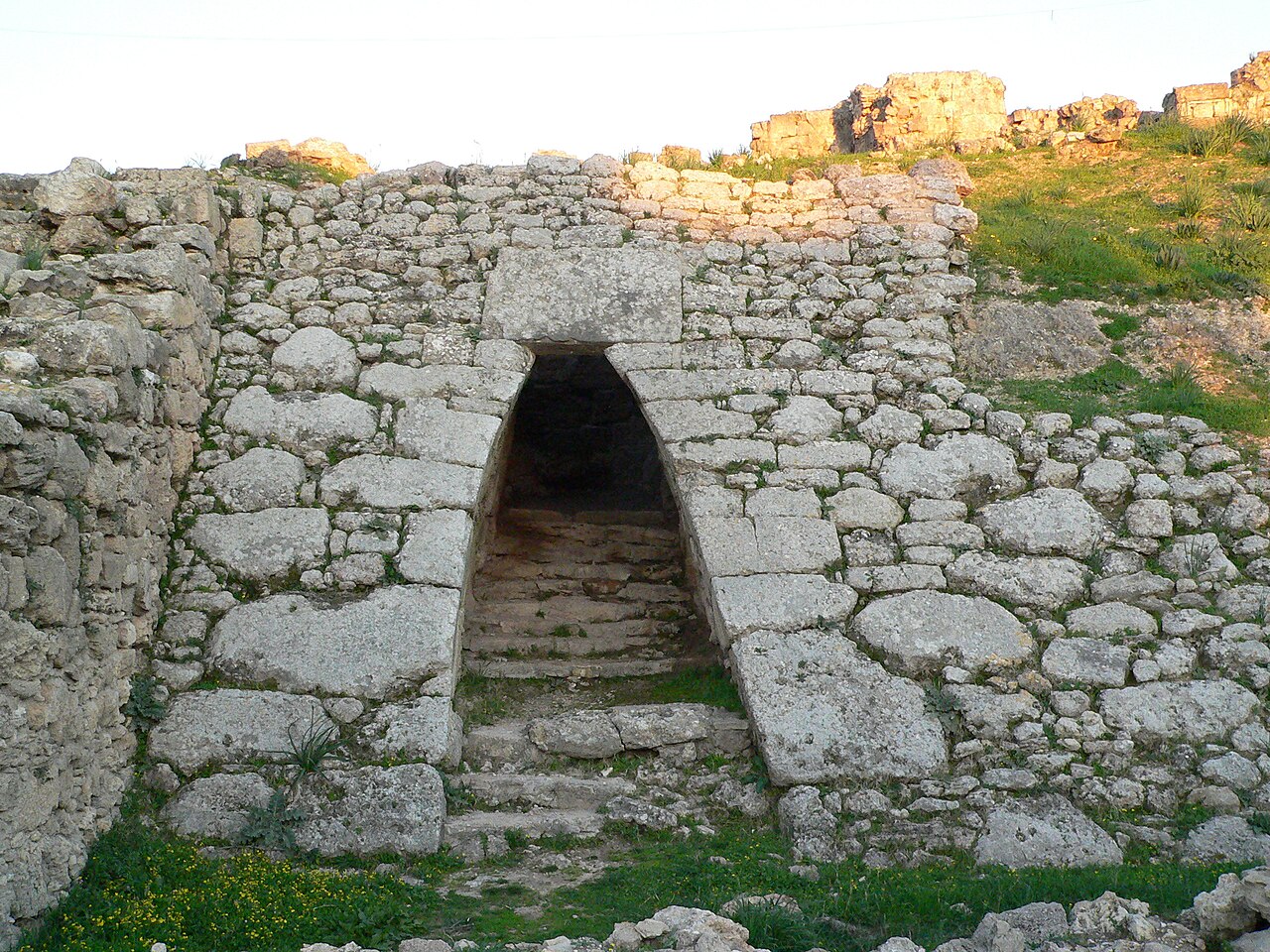
The Royal Palace of Ugarit is a Bronze Age ruins in the former port city of Ugarit on the Mediterranean coast of Syria. The royal residence of the rulers of the ancient Kingdom of Ugarit, it was excavated with the rest of the city from the 1930s by French archaeologist Claude F. A. Schaeffer, and is considered one of the most important finds made there.
The palace is located in the north-west corner of the former city, and originally spanned an area of 6,500 square metres (70,000 sq ft). Its surrounds were enclosed by a fortified wall that dates back to the 15th-century BC.
There were three entrances: the main gate on the northwest, protected by an array of towers with 5-metre (16 ft) thick walls and dubbed today "the Fortress", and smaller accesses in the northeast and the southwest.
The compound consisted of ninety rooms divided between two floors. The rooms were built around four large and four smaller courtyards. Its western end had a large garden, and three underground burial chambers were constructed in the structure’s north side. The ground floor was used for administrative purposes and included offices, archives, storage and staff dwellings. The second floor housed the family quarters, and was accessed through twelve staircases.
The palace was constructed in four major stages between the 15th and 13th-century BC. It was built out of ashlar stone blocks and wooden crossbeams, with walls covered in a thick coat of plain plaster. The fortified wall, which dates back to the 15th-century BC, was built with packed stones at the bottom and had an outward slope of 45 degrees.
The layout is typical of palaces of the Eastern Mediterranean and the Ancient Near East. Its irregular outline and asymmetrical layout are evidence of constant additions and alterations. The burial chambers had corbelled vaults which show a connection with Hittite and Mycenaean architecture.
After the chance discovery of Ugarit by local peasants in 1929, French archaeologist Claude F. A. Schaeffer led ten excavation campaigns at the site, which only covered the northwest corner. Work stopped with the advent of World War II and only resumed in 1948. Between 1950 and 1955 Schaeffer led concentrated excavations at the palace which unearthed a vast corpus of tablets and artefacts.
Objects found at the site include ivory carvings, furniture, stone stelae, and figurines.
Text adapted from “Royal Palace of Ugarit” on Wikipedia, CC BY-SA 4.0.
Royal Palace of Ugarit ranks #5,007 of 9,035 worldwide in the atlas's castle fame ranking, and #26 of the 38 mapped in Syria. Founded c. 1450 BC, it is older than 99% of the atlas's dated landmarks, one of 3 atlas entries founded in the 15th century BC. 1 more atlas landmarks stand within 25 km. The nearest day-trip guide is Latakia, 9 km away. It is one of the 105 landmarks on the atlas's regional map of the Levant. See how Syria compares in the castle statistics.
View on the interactive castle map →