 Romania · 13th century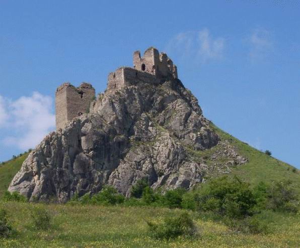
The Trascău Fortress, or citadel of Colțești (in Romanian: Cetatea Trascăului or Cetatea Colțeşti), today in ruins, is situated in Romania to the west of the village of Colțeşti (in Hungarian: Torockószentgyörgy, in German: Sankt Georgen) and about 5 km south-west of the commune of Rimetea (in Hungarian: Torockó, in German: Eisenburg), Alba County; it was built around 1296 by the vice-voivode Thorotzkay of Trascău as a habitable fortress and place of refuge.
Machine-translated from “Citadelle de Trascău” on the French Wikipedia, CC BY-SA 4.0.
Trascău Fortress ranks #5,652 of 9,035 worldwide in the atlas's castle fame ranking, and #54 of the 125 mapped in Romania. Founded c. 1296, it is older than 63% of the atlas's dated landmarks, one of 1090 atlas entries founded in the 13th century. 1 more atlas landmarks stand within 25 km. The nearest day-trip guide is Cluj-Napoca, 38 km away. It is one of the 78 landmarks on the atlas's regional map of Transylvania. It is stop 16 of 26 on the Transylvania castle route, Bran to Cluj-Napoca. See how Romania compares in the castle statistics.
View on the interactive castle map →