 Romania · 13th century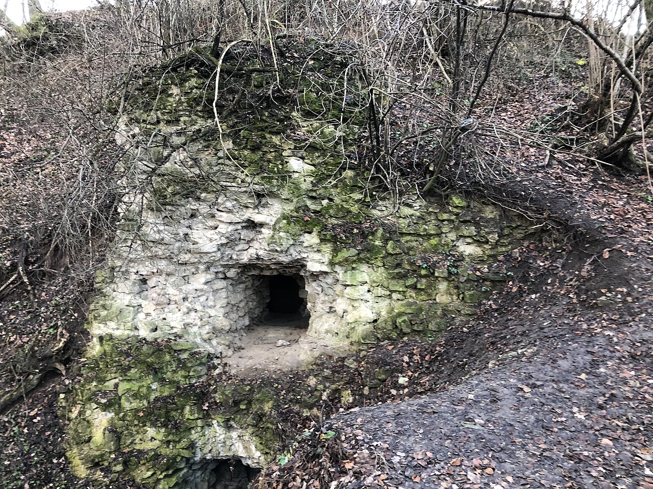
Cetatea Fetei (the Florești citadel) was a fortress built near the locality of Florești, on "Dealul Cetății, near the municipality of Cluj-Napoca".
The fortress was built before the year 1241 as a guard and observation point against the Tatar invasions. The fortress was probably pulled down in 1437, during the period of the Bobâlna peasant revolt.
After the suppression of the revolt the Catholic bishopric raised a new fortress at Gilău in 1439, which in practice took over the function of the Florești fortress.
The elliptical ruins of the fortress are found on a wooded summit situated at about 600 metres in altitude. 60 metres by 35 metres, the longer side being north-west and south-east. It is surrounded by embankments on the western side and by ditches on the other sides.
The archaeological excavations of the early 1990s revealed the remains of a wooden fortification 4.4 metres thick and of a stone wall, an unusual combination not previously known in medieval Transylvania.
The remaining ruins of the stone wall have a width of 6 metres, a height of 6.75 metres and an opening of 1.9 metres by 1.3 metres which crosses the stone wall at a depth of 1.5 metres.
At present there survive only a series of ruins and a shaft opening from which an underground tunnel starts, blocked a few metres in by an iron gate.
The name of the fortress comes from a local legend: it is said that during the Tatar invasions a girl from the village was caught by the Tatars and, despite torture, did not reveal the place where the village people had hidden. In her memory the fortress is said to have been named Cetatea Fetei (the Girl's Fortress).
In 2004 the ANL built a residential district in the area, which was named the Cetatea Fetei district.
Machine-translated from “Cetatea Fetei” on the Romanian Wikipedia, CC BY-SA 4.0.
Cetatea Fetei ranks #8,204 of 9,035 worldwide in the atlas's castle fame ranking, and #89 of the 125 mapped in Romania. Founded c. 1241, it is older than 71% of the atlas's dated landmarks, one of 1090 atlas entries founded in the 13th century. 5 more atlas landmarks stand within 25 km. The nearest day-trip guide is Cluj-Napoca, 8 km away. It is one of the 78 landmarks on the atlas's regional map of Transylvania. It is stop 18 of 26 on the Transylvania castle route, Bran to Cluj-Napoca. See how Romania compares in the castle statistics.
View on the interactive castle map →