Vesting
Mseilha Fort
🇱🇧 Libanon · 17e eeuw
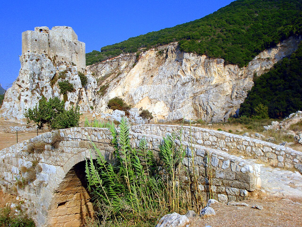
Het fort Mseilha (Arabisch: قلعة المسيلحة, getranscribeerd: Qalʿat al-Msaylḥa) is een historische vesting in Noord-Libanon, strategisch gelegen op de rechteroever van de Nahr al-Jaouz, in Hamat, ongeveer 2,5 kilometer ten noordoosten van de stad Batroun in Noord-Libanon. Door zijn ligging kon het fort belangrijke doorgangen door de vallei bewaken en de aloude paden rond de kustkaap Ras ash-Shaq'a controleren, een markante geologische formatie langs de Libanese kust die reizigers historisch gezien voor problemen stelde.
De naam Mseilha komt van het Arabische woord voor "versterkte plaats", een verkleinvorm van musallaha (Arabisch: مسلحة), wat "versterkt" betekent. Het huidige bouwwerk, opgetrokken op een kalksteenformatie, dateert uit de 17e eeuw en werd vermoedelijk in opdracht van emir Fakhr al-Din II gebouwd. Het bezit geen architectonische elementen uit de kruisvaarderstijd, hoewel historische bronnen suggereren dat de locatie tijdens de kruistochten versterkt kan zijn geweest. Het bestaande fort, gebouwd in traditioneel zandsteenmetselwerk, bestaat uit twee hoofddelen, tot twee meter dikke versterkte muren, een driehoekige binnenplaats en verdedigende schietgaten, met een ontwerp aangepast aan het omliggende terrein.
Het fort Mseilha wordt in sommige bronnen verward met de Puy du Connétable, een middeleeuws kruisvaardersdomein en vesting die de nabijgelegen kaap Ras ash-Shaq'a verdedigde. Architectonisch en historisch bewijs wijst er echter op dat het om afzonderlijke bouwwerken gaat, waarbij Mseilha in de Ottomaanse periode werd gebouwd, waarschijnlijk op of nabij de plek van de eerdere kruisvaardersversterkingen. Het fort Mseilha stond afgebeeld op het Libanese bankbiljet van 25 lira uit 1964.
Machinaal vertaald uit “Mseilha Fort” op de Engelstalige Wikipedia, CC BY-SA 4.0.
Mseilha Fort staat op plaats 3.647 van 8.134 in de bekendheidsranglijst van deze atlas en op plaats 8 van de 17 die de atlas in Libanon in kaart brengt. Gebouwd in ca. 1650, en daarmee ouder dan 26% van de gedateerde bouwwerken in de atlas — een van de 626 bouwwerken in de atlas die uit de 17e eeuw stammen. De Wikipedia-artikelen erover werden de afgelopen 60 dagen 1.126 keer geopend, meer dan 52% van de atlas. Binnen 25 km staan nog 3 andere bouwwerken uit de atlas. De dichtstbijzijnde dagtripgids is Tripoli, 22 km verderop. Dit is een van de 113 bouwwerken op de regiokaart de Levant. Zie hoe dat zich verhoudt in de kastelenstatistiek.
Bekijk op de interactieve kastelenkaart →Veelgestelde vragen
Waar ligt Mseilha Fort?
Mseilha Fort ligt in Libanon, op 34.2738°, 35.69008°.
Wanneer werd Mseilha Fort gebouwd?
De atlas dateert de stichting op ca. 1650. Er kunnen eerdere bouwwerken hebben gestaan; dit is het oudste gedocumenteerde bouwjaar.
Hoe bekend is Mseilha Fort?
In de bekendheidsranglijst van deze atlas: plaats 3.647 van 8.134 wereldwijd, plaats 8 in Libanon. Bekendheid combineert het aantal Wikipedia-taalversies met het aantal lezers.
Welk kasteel ligt het dichtst bij Mseilha Fort?
Leenschap Gibelet, ongeveer 18 km verderop.
Meer kastelen in Libanon
- Saint Louis Castle Libanon · 13e eeuw
- Fakhreddine Palace Libanon · 17e eeuw
- Fortress of Niha Libanon · 10e eeuw
- Moussa Castle Libanon · 20e eeuw
Meer vestingen
- Harilaq Fortress Kosovo
- Old town Đurđevac Kroatië · 14e eeuw
- Kasteel van Ishëm Albanië · 16e eeuw
- Fort Mackinac Verenigde Staten · 19e eeuw