 Armenia · 10th century
Akhtala Fotress ranks #7,641 of 9,040 worldwide in the atlas's castle fame ranking, and #26 of the 27 mapped in Armenia. Founded c. 950, it is older than 92% of the atlas's dated landmarks, one of 192 atlas entries founded in the 10th century. 3 more atlas landmarks stand within 25 km. The nearest day-trip guide is Tbilisi, 64 km away. See how Armenia compares in the castle statistics.
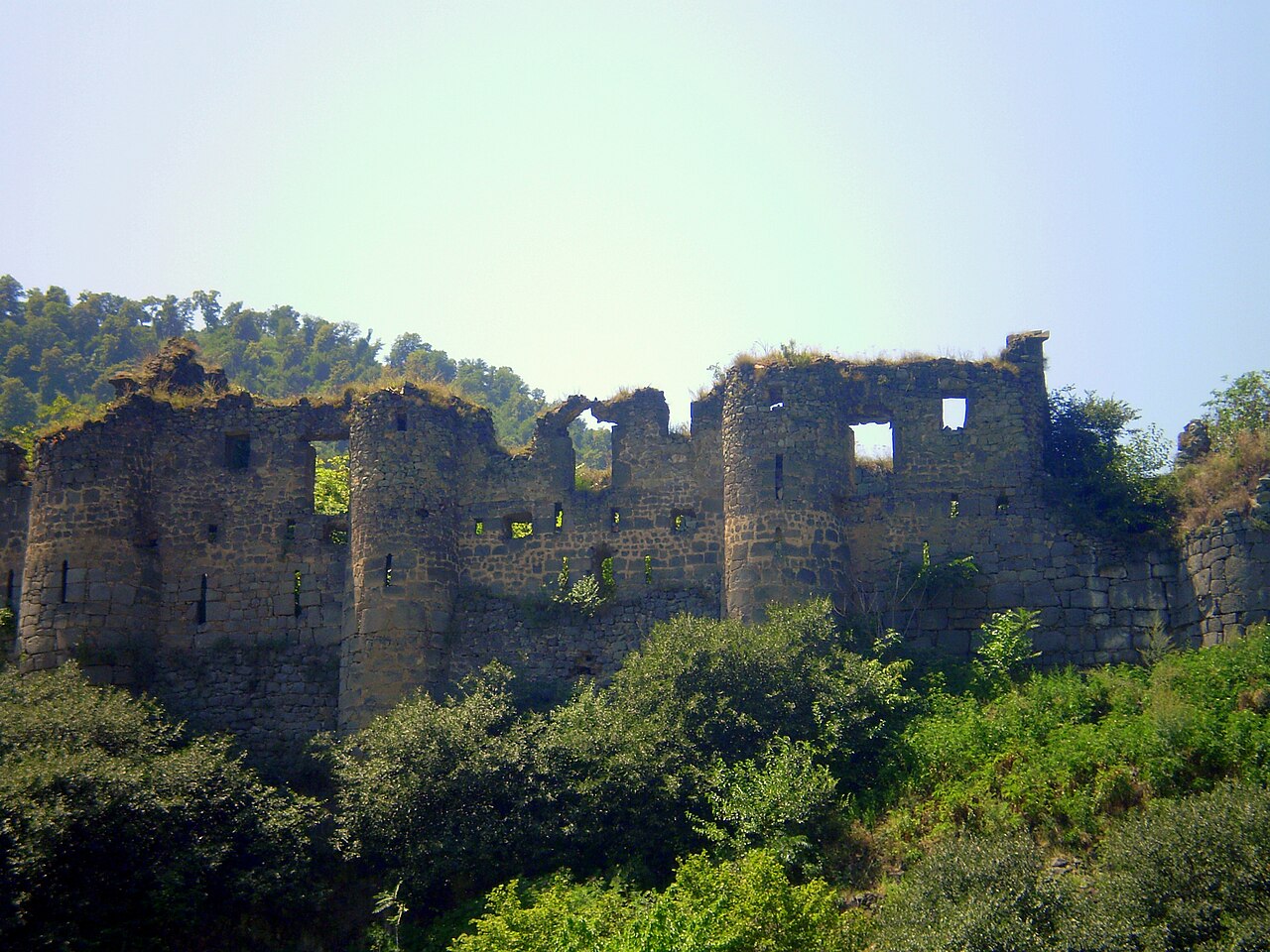
Akhtala Fotress (in Armenian: Ախթալայի բերդ) is a medieval building located in the town of Akhtala in the province of Lori in Armenia. It was built with a peninsula-like structure surrounded on three sides by deep cliffs.
Used as a natural position by the princely Bagratuni dynasty, branching into the Kiurikids (a younger branch of the Bagratunis and initially their vassals), in the 10th century they built this castle, joined by high pyramidal walls and with the main entrance between three-storey towers rising on either side.
The walls and towers are built of bluish basalt stone and lime mortar. The 13th-century Armenian historians Kirakos Gandzaketsi and Vardan Areveltsi called this area Pghndzahanq (copper mine), because of the rich copper deposits in its surroundings. Later the castle passed into the domain of the Zakarian dynasty under the rule of Ivane Zakarian in the 1180s. On the territory of the castle stands the monastery of Pghndzahanq, which later became known as the Monastery of Akhtala.
The French archaeologist, ethnographer and historian Jacques de Morgan was in the 19th century the director of the copper mines of Akhtala. Excavations were carried out at the fortress and antiquities were discovered, which are kept in Paris.
Machine-translated from “Fortaleza Ajtala” on the Spanish Wikipedia, CC BY-SA 4.0.
View on the interactive castle map →