Fortress
Sardar's Fortress
🇦🇲 Armenia · 19th century
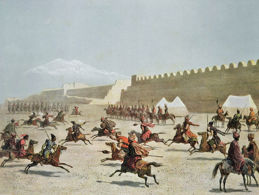
Sardarabad (Armenian: Սարդարապատ, romanized: Sardarapat; Persian: سردارآباد, romanized: Sardâr-âbâd), also known as Sardari Berd (Armenian: Սարդարի բերդ, lit. 'Sardar's fortress'), was a 19th-century fortress and urban center built in the Erivan Khanate in Qajar Iran, in the territory of modern-day Armenia. Its ruins are located near the village of Nor Armavir in the Armavir Province of Armenia.
The fortress was built under Hossein Qoli Khan (r. 1807–1828), the sardar of Erivan (Yerevan). It was established to protect the usual invasion route from Russia and the Ottoman Empire and to serve as a summer residence for the khanate's rulers. The sardar's brother Hasan Khan made the fortress his usual residence, using it to conduct raids into Georgia and the Ottoman Empire. British experts participated in the construction of the fortress. French engineers fortified the fortress around 1808. It was constructed mainly using stones taken from the ruins of the hilltop fortress of the ancient city of Armavir (earlier Urartian Argishtikhinili).
The fortress was quadrangular and had four gates and double walls fortified with large towers. The khan's palace and storehouses were located next to the southern wall and were surrounded by large gardens, which were irrigated by the water of a canal from the Aras River to the fortress. The newly built fortress became a minor urban center inhabited by about 500 Armenians—mostly artisans and merchants—originating from Bayazit and Arjesh in the Ottoman Empire. The considerable Muslim population of the fortress consisted mainly of military personnel and departed in its entirety after the fall of the fortress in 1827. The Armenian population founded a church called Surb Astvatsatsin (St. Mary's), which had its own school. The sardar established a customs house and caravanserai near the fortress to take advantage of the caravan route from Erzurum and Kars which passed through Sardarabad.
The fortress was still not fully completed when the Russo-Persian War of 1826–1828 broke out. Sardarabad was besieged by Russian troops under the command of General Afanasy Krasovsky in September 1827. The fortress was defended by a garrison of 2000 soldiers under the command of Hasan Khan. The southern wall collapsed because of shelling, and Hasan Khan fled the fortress on the night of September 19.
Text adapted from “Sardarabad (fortress)” on Wikipedia, CC BY-SA 4.0.
Sardar's Fortress ranks #7,135 of 8,134 worldwide in the atlas's castle fame ranking, and #27 of the 28 mapped in Armenia. Founded 1807, it is older than 12% of the atlas's dated landmarks — one of 607 atlas entries founded in the 19th century. The nearest day-trip guide is Iğdır, 24 km away. See how Armenia compares in the castle statistics.
View on the interactive castle map →Frequently asked questions
Where is Sardar's Fortress?
Sardar's Fortress stands in Armenia, at 40.1361°, 44.0139°.
When was Sardar's Fortress built?
The atlas dates its founding to 1807. Earlier structures may have stood on the site; this is the earliest documented founding year.
How famous is Sardar's Fortress?
In this atlas's fame ranking: #7,135 of 8,134 worldwide, and #27 in Armenia. Fame here combines how many Wikipedia language editions cover a landmark with how many people read them.
What is the nearest castle to Sardar's Fortress?
Dashtadem Fortress, about 26 km away.
More castles in Armenia
- Garni Fortress Armenia · 3rd century BC
- Erebuni Fortress Armenia · 8th century BC
- Teishebaini (Karmir Blur) Armenia
- Erivan Fortress Armenia · 16th century
More fortresses
- Khunzakh Fortress Russia · 19th century
- Ufa Kremlin Russia · 16th century
- Fort 5 - King Frederick Wilhelm III Russia
- Fort van den Bosch Indonesia