 Palestine · 1st century BC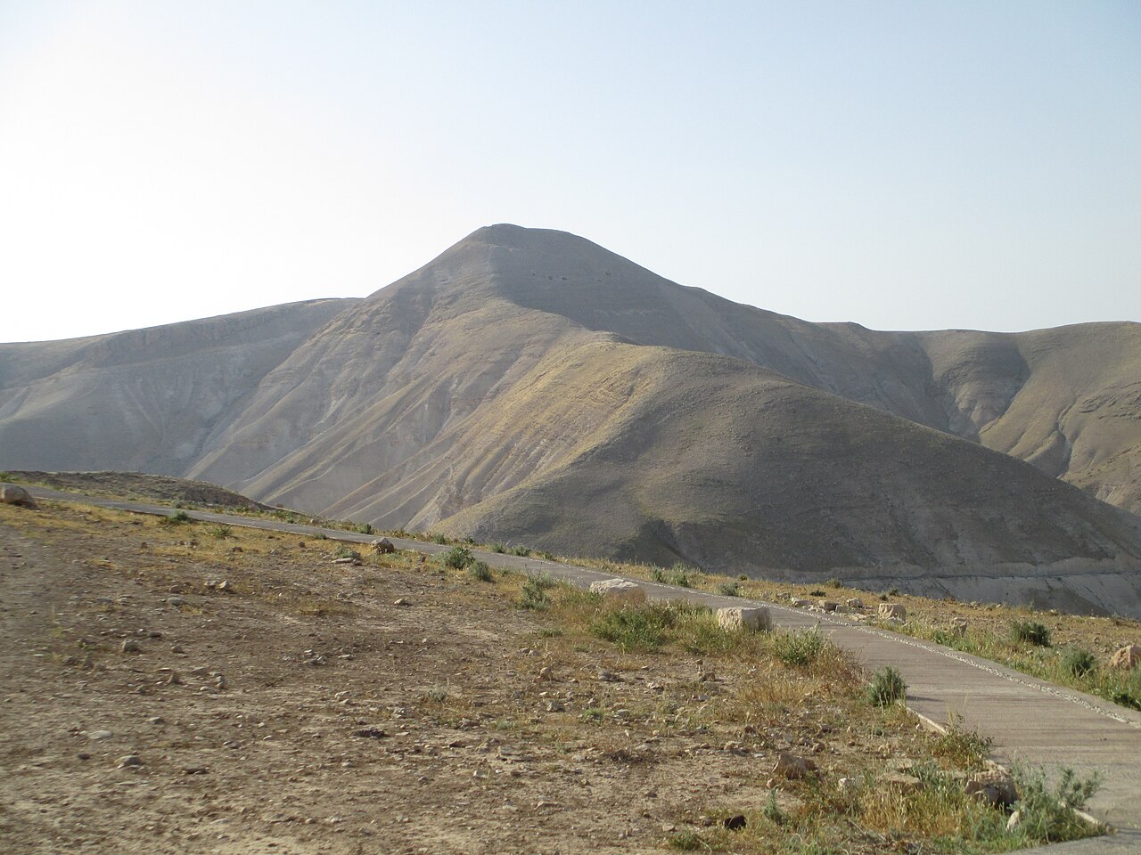
Alexandreion (Greek), or Alexandrium (Latin), called Sartaba in the Mishna and Talmud and Qarn Sartaba in Arabic, was an ancient hilltop fortress constructed by the Hasmoneans between Scythopolis and Jerusalem on a pointy barren hill towering over the Jordan Valley from the west. It was likely named after Hasmonean king Alexander Jannæus (104–77 BCE).
The fortress called "Alexandreion" in Greek, simplified to "Alexandrion" (and Latinised as "Alexandrium"), is mentioned by Josephus in his Antiquities of the Jews. It was mentioned in the Mishna and Talmud as "Sartaba" and is now called "Qarn Sartabe" (lit. "Horn of Sartabe") in Arabic.
Alexandrium was constructed by the Hasmoneans near the border with Samaria to accommodate a military garrison, as well as to guard political prisoners. It is later mentioned during Pompey the Great's conquest of Judea as a stronghold of Aristobulus II: "...as he passed by Pella and Scythopolis, he came to Corem, which is the first entrance into Judea when one passes over the midland countries, where he came to a most beautiful fortress that was built on the top of a mountain called Alexandrium, whither Aristobulus had fled/" The Alexandreion was restored by Herod the Great, a task he assigned to his brother Pheroras.
Herod gave it the character of a palatial desert fortress, similar to those he built or rebuilt at Masada, Herodion and Machaerus. Herod used the fortress as a prison for his political opponents, holding his 2nd wife, Mariamne and her mother, Alexandra there in 30 BCE. It was also the burial site of Alexander, son of Herod, and Aristobulus, two of his sons whom Herod had executed at Sebaste in 7 BCE.
Alexandrium was finally razed by Vespasian or Titus during the Great Revolt.
Excavations conducted in the site in the 1980s by archaeologist Yoram Tsafrir uncovered remains from the Hasmonean period, including parts of columns and capitals. In excavations conducted in 2025, led by archaeologist Dvir Raviv, five construction phases were identified on the eastern slope. The first two date to the Hasmonean period, and include a building whose walls and floor were plastered in white, a ritual bath (Mikveh), and parts of a columned structure decorated in the Doric style.
Text adapted from “Alexandrium” on Wikipedia, CC BY-SA 4.0.
Alexandreion ranks #1,692 of 9,079 worldwide in the atlas's castle fame ranking, and #3 of the 5 mapped in Palestine. Founded c. 76 BC, it is older than 99% of the atlas's dated landmarks — one of 16 atlas entries founded in the 1st century BC. Its Wikipedia articles were opened 2,211 times in the last 60 days, more than 72% of the atlas. 1 more atlas landmarks stand within 25 km. The nearest day-trip guide is Nablus, 23 km away. It is one of the 106 landmarks on the atlas's regional map of the Levant. See how Palestine compares in the castle statistics.
View on the interactive castle map →