Ruin
Hisham's Palace
 Palestine · 8th century
- Founded
- c. 725
- Heritage status
- Tentative World Heritage Site
- Location
- Jericho Governorate
- Coordinates
- 31.8819°, 35.4598°
- Open data
- Wikidata Q2456319
- Links
- OpenStreetMap · Wikimedia Commons · Plan
Description
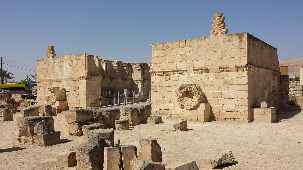
Hisham's Palace (Arabic: قصر هشام Qaṣr Hishām), also known as Khirbat al-Mafjar (Arabic: خربة المفجر), is an important early Islamic archaeological site in the city of Jericho, in the West Bank in Palestine. Built by the Umayyad dynasty in the first half of the 8th century, it is one of the so-called Umayyad desert castles. It is located 3 kilometres (2 mi) north of Jericho's city center, in an area governed by the Palestinian National Authority (PNA). The palace was used until the 11th century, and it may have been destroyed by an earthquake in 1033.
Spreading over 60 hectares (150 acres), the site consists of three main parts: a palace, an ornate bath complex, and an agricultural estate. The entire complex – palace, baths, and farm – was connected to nearby springs by an elaborate water system. The site is on the tentative list of World Heritage Sites and has been open to the public since 2021. The palace has one of the largest continuous mosaic floors in the world covering nearly 850 square metres (9,100 sq ft).
Text adapted from “Hisham's Palace” on Wikipedia, CC BY-SA 4.0.
In the rankings
Hisham's Palace ranks #761 of 9,902 worldwide in the atlas's castle fame ranking, and #2 of the 5 mapped in Palestine. Founded c. 725, it is older than 96% of the atlas's dated landmarks, one of 51 atlas entries founded in the 8th century. Its Wikipedia articles were opened 6,343 times in the last 60 days, more than 91% of the atlas. 6 more atlas landmarks stand within 25 km. The nearest day-trip guide is Jerusalem, 24 km away. It is one of the 108 landmarks on the atlas's regional map of the Levant. See how Palestine compares in the castle statistics.
Castles nearby
- Cypros5 km · Palestine
- Alexandreion24 km · Palestine
- Antonia Fortress
 24 km · Israel
- Herod's Palace at Jerusalem25 km · Israel
More castles in Palestine
- Qasr al-BashaPalestine · 13th century
- HerodiumPalestine · 1st century BC