 Scotland · 2nd century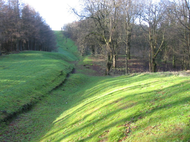
The Antonine Wall (Latin: Vallum Antonini) was a turf fortification on stone foundations, built by the Romans across what is now the Central Belt of Scotland, between the Firth of Clyde and the Firth of Forth. Built some twenty years after Hadrian's Wall to the south, and intended to supersede it, while it was garrisoned it was the northernmost frontier barrier of the Roman Empire. It spanned approximately 63 kilometres (39 miles) and was about 3 metres (10 feet) high and 5 metres (16 feet) wide. Lidar scans have been carried out to establish the length of the wall and the Roman distance units used. Security was bolstered by a deep ditch on the northern side.
It is thought that there was a wooden palisade on top of the turf. The barrier was the second of two "great walls" created by the Romans in Great Britain in the second century AD. Its ruins are less evident than those of the better-known and longer Hadrian's Wall to the south, primarily because the turf and wood wall has largely weathered away, unlike its stone-built southern predecessor.
Construction began in AD 142 at the order of Roman Emperor Antoninus Pius. Estimates of how long it took to complete vary widely, with six and twelve years most commonly proposed. Antoninus Pius never visited Britain, unlike his predecessor Hadrian. Pressure from the Caledonians probably led Antoninus to send the empire's troops farther north. The Antonine Wall was protected by 16 forts with small fortlets between them; troop movement was facilitated by a road linking all the sites known as the Military Way. The soldiers who built the wall commemorated the construction and their struggles with the Caledonians with decorative slabs, twenty of which survive. The wall was abandoned only eight years after completion, and the garrisons relocated rearward to Hadrian's Wall.
Text adapted from “Antonine Wall” on Wikipedia, CC BY-SA 4.0.
Antonine Wall ranks #69 of 9,079 worldwide in the atlas's castle fame ranking, and #3 of the 226 mapped in Scotland. Founded 142, it is older than 98% of the atlas's dated landmarks — one of 21 atlas entries founded in the 2nd century. Its Wikipedia articles were opened 34,212 times in the last 60 days, more than 99% of the atlas. 10 more atlas landmarks stand within 25 km. The nearest day-trip guide is Glasgow, 16 km away. See how Scotland compares in the castle statistics.
View on the interactive castle map →