 France · 19th century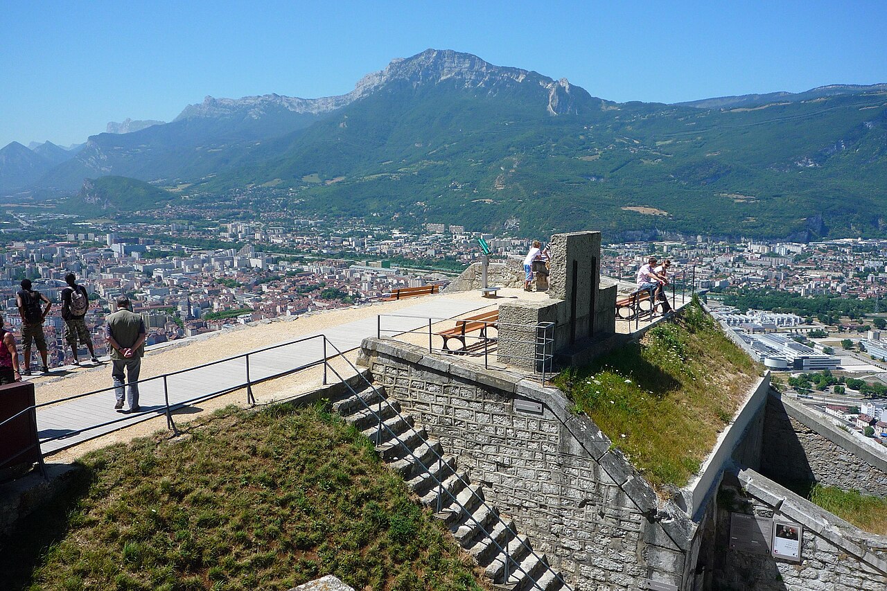
The Bastille is a fortress culminating at 476 m (1,561ft) above sea level, located at the south end of the Chartreuse mountain range and overlooking the city of Grenoble, France. The Bastille, which also gives its name to the hill, is the main tourist site of the Grenoble area, with 600,000 visitors per year.
The fortress lies on the final promontory of Mount Rachais, a narrow mountain that is the most southerly of the Chartreuse range.
The plateau of the fortress' main fortifications is situated 264 metres above a singularly flat valley floor which is glacial in origin. The melting of the Isère glacier approximately 25,000 years ago led to the formation of a vast lake stretching from Voiron to Albertville and which remained for approximately 10,000 years. The filling-in of this lake by alluvial deposits created the perfectly flat valley floors that are in evidence today.
The location was chosen for a fort because it facilitated the surveillance and control of the city of Grenoble, from the 19th century onward, as well as the valleys of the Isère and the Drac, all the while being difficult to attack and overthrow because of the cliffs and steep ground by which it is surrounded.
Francis I in 1538 and Charles IX in 1566 both asked that this hill be fortified, but these requests were not acted upon.
In December 1590, Lesdiguières, head of the Huguenots in the Dauphiné, took control of the city of Grenoble from the Roman Catholic side during the eighth and last Wars of Religion. With an army of 1,200 men gathered at Moirans, he marched towards Grenoble, passing through Saint-Martin-le-Vinoux and then over the spur of Mount Rachais called the Rabot, avoiding a fortified stronghold there. A single cannon was positioned on the slopes of Mount Rachais, because this rocky spur was thought to be enough of a natural barrier to deter the advance of hostile forces. But in spite of a permanent state of alert and 24 watch points in the city, Grenoble fell to Lesdiguières after more than three weeks under siege.
In 1591, having become governor of Grenoble, Lesdiguières immediately ordered the construction of two new defensive elements for the city.
Text adapted from “Bastille (Grenoble)” on Wikipedia, CC BY-SA 4.0.
Bastille (Grenoble) ranks #2,349 of 9,035 worldwide in the atlas's castle fame ranking, and #182 of the 787 mapped in France. Founded c. 1850, it is older than 7% of the atlas's dated landmarks, one of 705 atlas entries founded in the 19th century. Its Wikipedia articles were opened 3,771 times in the last 60 days, more than 82% of the atlas. 2 more atlas landmarks stand within 25 km. The nearest day-trip guide is Annecy, 84 km away. See how France compares in the castle statistics.
View on the interactive castle map →