Fortress
Celtic circular wall of Otzenhausen
🇩🇪 Germany · 4th century BC
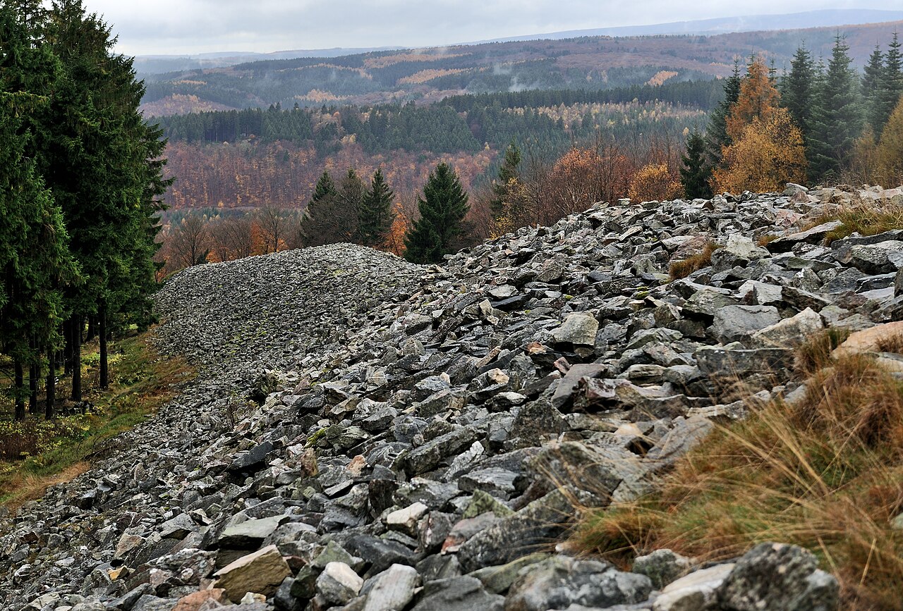
The Celtic hill fort of Otzenhausen is one of the biggest fortifications the Celts ever constructed.
It was built by the Treveri tribe, who lived in the region north of the fort. The fort is located on top of the Dollberg, a hill near Otzenhausen in Germany, about 695 m above sea level. The only visible remains are two circular earth ramparts, covered with stones.
In times of war, the circular rampart was a strong fortification against enemies. Theories suggest this one might have been more than just a refuge. There might have been a permanent settlement, a village or the seat of a local leader.
The first fortification was constructed in the 5th or 4th century BC, but the real heyday of construction dates to the 2nd and 1st century BC. For reasons yet unknown, the fort was abandoned shortly after this expansion, in the middle stages of the La Tène culture.
The site is formed in the shape of a triangle with rounded ends. One rampart surrounds the whole fort. On the southern side, another similar embankment is built about 40 metres in front of the main one. The ends of this outer rampart approach the main one but do not touch it. Because the entrance of the main rampart is located on the western side, no significant purpose for the outer one has been determined. From west to east the fort extends 460 m, from north to south 647 m. The total length of the ramparts is 2500 metres and they contain 240,000 cubic metres of stone. Thousands of beams were attached to the ramparts which, as the diagram shows, probably presented a vertical stone wall to the exterior.
But this is usually the form of all the Gallic walls. Straight beams, connected lengthwise and two feet distant from each other at equal intervals, are placed together on the ground; these are mortised on the inside, and covered with plenty of earth. But the intervals which we have mentioned, are closed up in front by large stones. These being thus laid and cemented together, another row is added above, in such a manner that the same interval may be observed, and that the beams may not touch one another, but equal spaces intervening, each row of beams is kept firmly in its place by a row of stones. In this manner the whole wall is consolidated, until the regular height of the wall be completed.
Text adapted from “Hillfort of Otzenhausen” on Wikipedia, CC BY-SA 4.0.
Celtic circular wall of Otzenhausen ranks #3,721 of 8,134 worldwide in the atlas's castle fame ranking, and #288 of the 505 mapped in Germany. Founded c. 350 BC, it is older than 99% of the atlas's dated landmarks — one of 12 atlas entries founded in the 4th century BC. Its Wikipedia articles were opened 2,254 times in the last 60 days, more than 69% of the atlas. The nearest day-trip guide is Trier, 30 km away. It is one of the 43 landmarks on the atlas's regional map of the Moselle. See how Germany compares in the castle statistics.
View on the interactive castle map →Frequently asked questions
Where is Celtic circular wall of Otzenhausen?
Celtic circular wall of Otzenhausen stands in Germany, at 49.6231°, 7.00222°.
When was Celtic circular wall of Otzenhausen built?
The atlas dates its founding to c. 350 BC. Earlier structures may have stood on the site; this is the earliest documented founding year.
How famous is Celtic circular wall of Otzenhausen?
In this atlas's fame ranking: #3,721 of 8,134 worldwide, and #288 in Germany. Fame here combines how many Wikipedia language editions cover a landmark with how many people read them.
What is the nearest castle to Celtic circular wall of Otzenhausen?
Burg Baldenau, about 26 km away.
More castles in Germany
- Schloss Heiligenberg (Jugenheim) Germany
- Anhalt Castle Germany · 12th century
- Blankenburg Castle Germany · 12th century
- Hohengeroldseck Germany · 13th century
More fortresses
- Heldburg Fortress Germany · 16th century
- Veste Oberhaus Germany · 13th century
- Ditchan Kala Uzbekistan · 19th century
- Saint-Nazaire pocket France