Ruin
Deir el-Munira
🇪🇬 Egypt
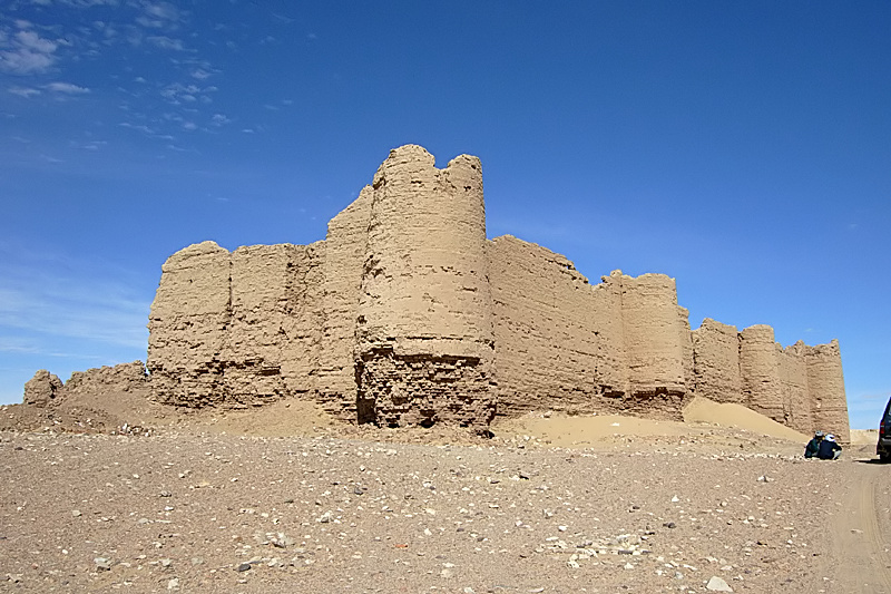
Deir el-Munira, also called Hisn al-Deir or Deir al-Ghanayim, is an archaeological site about 23 km north of the city of Kharga and 3 km east of the village of El-Munira. The site includes a Roman fort that is among the largest Roman forts in the Kharga Oasis, built to guard the main desert road towards Farshut and the Nile Valley. The site also includes a Roman temple of mud brick close to the fort.
Machine-translated from “دير المنيرة” on the Arabic Wikipedia, CC BY-SA 4.0.
Deir el-Munira ranks #8,013 of 8,134 worldwide in the atlas's castle fame ranking, and #37 of the 37 mapped in Egypt. 1 more atlas landmarks stand within 25 km. See how Egypt compares in the castle statistics.
View on the interactive castle map →Frequently asked questions
Where is Deir el-Munira?
Deir el-Munira stands in Egypt, at 25.59676°, 30.73042°.
How famous is Deir el-Munira?
In this atlas's fame ranking: #8,013 of 8,134 worldwide, and #37 in Egypt. Fame here combines how many Wikipedia language editions cover a landmark with how many people read them.
What is the nearest castle to Deir el-Munira?
Qasr el-Labakha, about 22 km away.
More castles in Egypt
- Urabi Fortress Egypt
- Cairo Citadel Egypt · 12th century
- Pharaoh's Island Egypt · 12th century
- Babylon Fortress Egypt · 3rd century
More ruins
- Ludlow Castle, Delhi India
- Rustavi Fortress Georgia
- Seraya Loshad Fort Russia · 20th century
- Amiuk Turkey