 Scotland · 11th century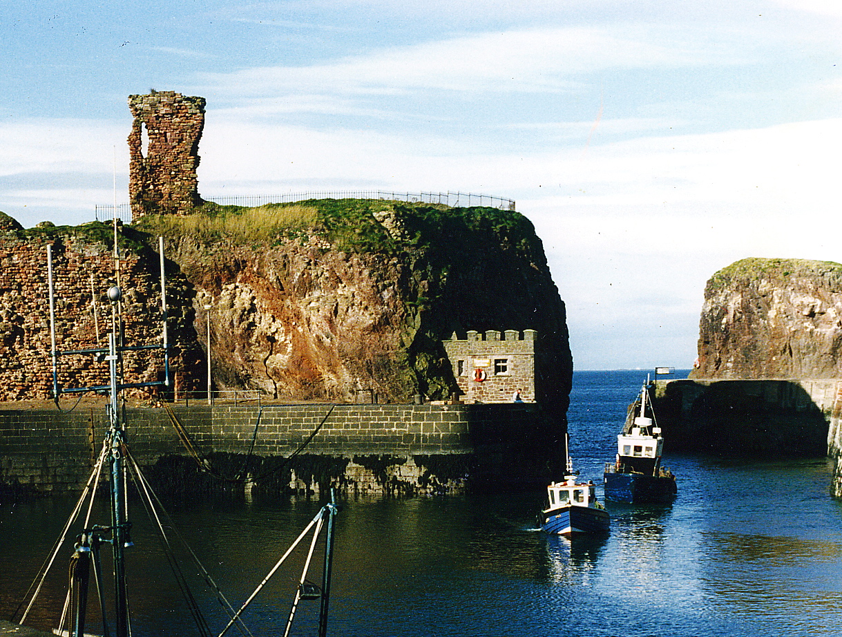
Dunbar Castle was one of the strongest fortresses in Scotland, situated in a prominent position overlooking the harbour of the town of Dunbar, in East Lothian. Several fortifications were built successively on the site, near the English-Scottish border. The last was slighted in 1567; it is a ruin today.
The body of buildings measured in excess of 165 feet (50 m) from east to west, and in some places up to 210 feet (64 m) from north to south. The South Battery, which Grose supposes to have been the citadel or keep, is situated on a detached perpendicular rock, only accessible on one side, 72 feet (22 m) high, and is connected to the main part of the castle by a passage of masonry measuring 69 feet (21 m). The interior of the citadel measures 54 by 60 feet (16 m × 18 m) within the walls. Its shape is octagonal. Five of the gun-ports remain, which are called the 'arrow-holes'. They measure 4 feet (1.2 m) at the mouth and only 16 inches (41 cm) at the other end. The buildings are arched and extend 8 feet (2.4 m) from the outer walls, and look into an open court, whence they derive their light.
About the middle of the fortress, part of a wall remains, through which there is a gateway, surmounted with armorial bearings. This gate seems to have led to the principal apartments. In the centre, are the arms of George, 10th Earl of Dunbar, who succeeded his uncle in 1369, and who besides the earldom of Dunbar and March, inherited the Lordship of Annandale and the Isle of Man from his heroic aunt, Black Agnes of Dunbar. They must have been placed there after his succession, as he was the first who assumed those sculptured Arms: viz, a large triangular shield, and thereon a lion rampant, within a bordure charged with eight roses. The shield is adorned with a helmet, carrying a crest: a horse's head bridled. On the right are the Arms of the Bruces, and on the left those of the Isle of Man.
The castle towers had communication with the sea, and dip low in many places. North-east from the front of the castle is a large natural cavern, chiefly of black stone, which looks like the mouth of the Acheron – a place that leads to melancholy streams. This spot is supposed to have formed part of the dungeon where prisoners were confined, such as Gavin Douglas, Bishop of Dunkeld, who was a prisoner here in 1515.
Text adapted from “Dunbar Castle” on Wikipedia, CC BY-SA 4.0.
Dunbar Castle ranks #1,489 of 9,079 worldwide in the atlas's castle fame ranking, and #49 of the 226 mapped in Scotland. Founded 1070, it is older than 88% of the atlas's dated landmarks — one of 436 atlas entries founded in the 11th century. Its Wikipedia articles were opened 4,150 times in the last 60 days, more than 84% of the atlas. 4 more atlas landmarks stand within 25 km. The nearest day-trip guide is Edinburgh, 42 km away. See how Scotland compares in the castle statistics.
View on the interactive castle map →