 England
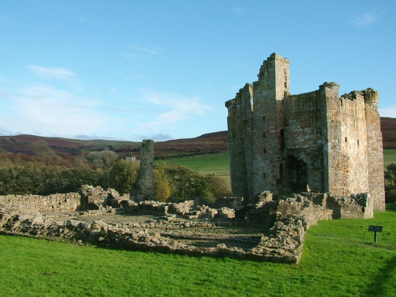
Edlingham Castle ranks #3,601 of 9,040 worldwide in the atlas's castle fame ranking, and #248 of the 360 mapped in England. 6 more atlas landmarks stand within 25 km. The nearest day-trip guide is Newcastle upon Tyne, 46 km away. It is one of the 19 landmarks on the atlas's regional map of Northumberland. It is stop 11 of 18 on the Northumberland castle coast, Newcastle upon Tyne to Berwick-upon-Tweed. See how England compares in the castle statistics.
Edlingham Castle is a small castle ruin, having scheduled monument and Grade I listed building status, in the care of English Heritage. It is located in a valley to the west of Alnwick, Northumberland, England. It has been described as "...one of the most interesting in the county", by Nikolaus Pevsner, the architectural historian. Edlingham itself is little more than a hamlet with a church alongside the castle.
The ruins are mostly laid low, though much of the solar tower still stands despite an impressive crack running several storeys down to ground level. The foundations and part of the walls of the hall house, gatehouse, barbican and other courtyard buildings are still visible, most dating from the 16th century.
The castle – more properly a fortified manor house typical of many medieval houses in the North of England – guards one of the few approaches to Alnwick through the hills to its west. Its fortifications were increased in response to the border warfare which raged between England and Scotland in the period from about 1300 to 1600.
Text adapted from “Edlingham Castle” on Wikipedia, CC BY-SA 4.0.
View on the interactive castle map →