Fortress
Fort de la Pompelle
🇫🇷 France · 19th century
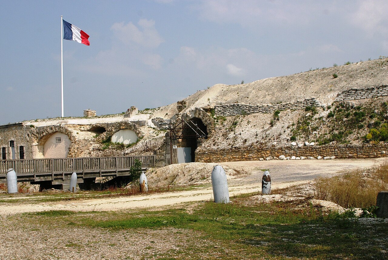
The Fort de la Pompelle, also known as Fort Herbillon, is one of a number of forts built around Reims after 1870 as part of a fortification belt in the Séré de Rivières system. The forts saw combat during the First World War in the defense of Reims. The fort is located about 2 kilometres (1.2 mi) north of the town of Sillery, next to the N44 road, between Reims and Châlons-en-Champagne. Constructed as a supporting position for larger forts and disarmed in 1913, it saw the heaviest fighting of the Reims forts. It was bombarded during the war and remains in a state of ruin.
Text adapted from “Fort de la Pompelle” on Wikipedia, CC BY-SA 4.0.
Fort de la Pompelle ranks #5,360 of 8,764 worldwide in the atlas's castle fame ranking, and #464 of the 675 mapped in France. Founded 1883, it is older than 5% of the atlas's dated landmarks — one of 655 atlas entries founded in the 19th century. Its Wikipedia articles were opened 1,281 times in the last 60 days, more than 56% of the atlas. 1 more atlas landmarks stand within 25 km. The nearest day-trip guide is Compiègne, 97 km away. See how France compares in the castle statistics.
View on the interactive castle map →Frequently asked questions
Where is Fort de la Pompelle?
Fort de la Pompelle stands in France, at 49.21611°, 4.12917°.
When was Fort de la Pompelle built?
The atlas dates its founding to 1883. Earlier structures may have stood on the site; this is the earliest documented founding year.
How famous is Fort de la Pompelle?
In this atlas's fame ranking: #5,360 of 8,764 worldwide, and #464 in France. Fame here combines how many Wikipedia language editions cover a landmark with how many people read them.
What is the nearest castle to Fort de la Pompelle?
Palace of Tau, about 8 km away.
More castles in France
- Fort des Têtes France · 18th century
- Fort du Mont Bart France · 19th century
- Fort du Salbert France · 19th century
- Fort l'Écluse France · 13th century
More fortresses
- Fortress of Miolans France · 11th century
- Tour Royale France · 16th century
- Fort Constantin Germany · 19th century
- Lichtenau Fortress Germany