 Germany · 16th century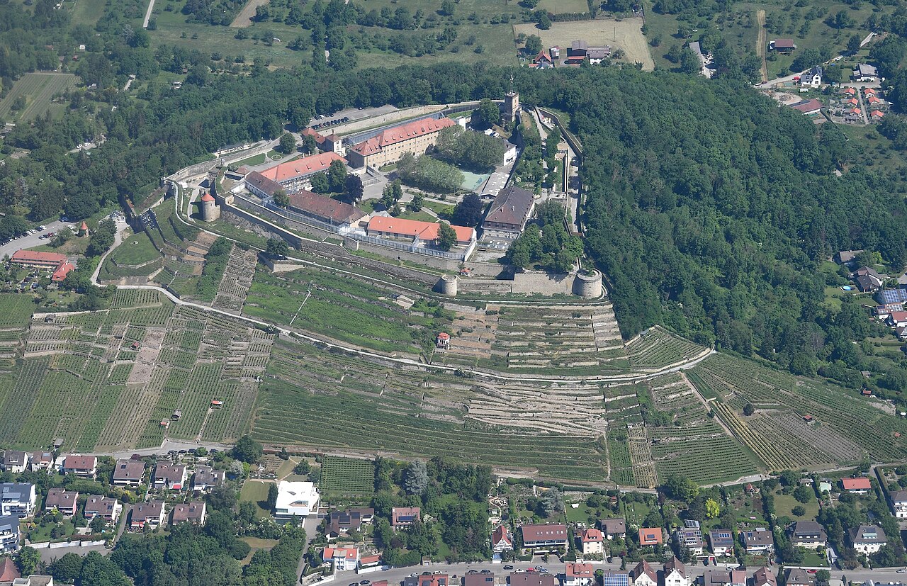
Hohenasperg, located in the federal state of Baden-Württemberg near Stuttgart, Germany, of which it is administratively part, is an ancient fortress and prison overlooking the town of Asperg.
It was an important Celtic oppidum, and a number of very important "princely" burials are close by, in particular the Hochdorf Chieftain's Grave.
Hohenasperg is located on a 90-metre-high Late Triassic hill. The hill is located in an upland area, but because of its steep overhangs and wide plateau, it is visible from a long distance and offers an ideal location for a fortification.
Around 500 BC, during the Hallstatt period, the Hohenasperg was a Celtic principality with a fortified settlement, known as a 'princely seat'. Numerous Celtic burial sites in the surrounding area are aligned so as to offer a line of sight to the Hohenasperg, e.g. the large Hochdorf Chieftain's Grave, the Ludwigsburg-Römerhügel grave, and the Grafenbühl grave on the Katharinenlinde by Schwieberdingen. Kleinaspergle, which has been well-known since an excavation in 1839, is a burial mound lying 1,000 metres south of Hohenasperg, which offers an exceptionally good view of the Hohenasperg.
Around 500 AD, after the victory of the Franks over the Alamanni, Hohenasperg became the seat of the Frankish Lord and Frankish Thing, the legislative assembly. At this time Hohenasperg was called "Ascicberg."
The first time Asperg was referred to was in the year 819, as the Shire Gozberg granted local suzerainty to Weissenburg Abbey in the Alsace. The location however achieved more importance in the 13th century with the founding of the independent town of Hohenasperg, which lasted until 1909.
Hohenasperg was officially chartered in 1510. In 1519, forces of the Swabian League under George von Frundsberg laid siege to Hohenasperg where Duke Ulrich of Württemberg was holding out.
On 12 May 1525, the peasant leader, Jäcklein Rohrbach, was taken prisoner by the governor of Asperg. He was held there until the surrender of the Steward of Waldburg-Zeil. After 1535, the castle was expanded and turned into a fortress. The residents were resettled at the foot of the hill.
Between 1634 and 1635, during the Thirty Years War, the castle was defended against imperial troops by a garrison of Protestants from Württemberg, reinforced by Swedish forces.
Text adapted from “Hohenasperg” on Wikipedia, CC BY-SA 4.0.
Hohenasperg ranks #1,699 of 9,079 worldwide in the atlas's castle fame ranking, and #132 of the 711 mapped in Germany. Founded 1535, it is older than 41% of the atlas's dated landmarks — one of 891 atlas entries founded in the 16th century. Its Wikipedia articles were opened 3,723 times in the last 60 days, more than 82% of the atlas. 13 more atlas landmarks stand within 25 km. The nearest day-trip guide is Stuttgart, 15 km away. See how Germany compares in the castle statistics.
View on the interactive castle map →