Ruin
Los Millares
🇪🇸 Spain
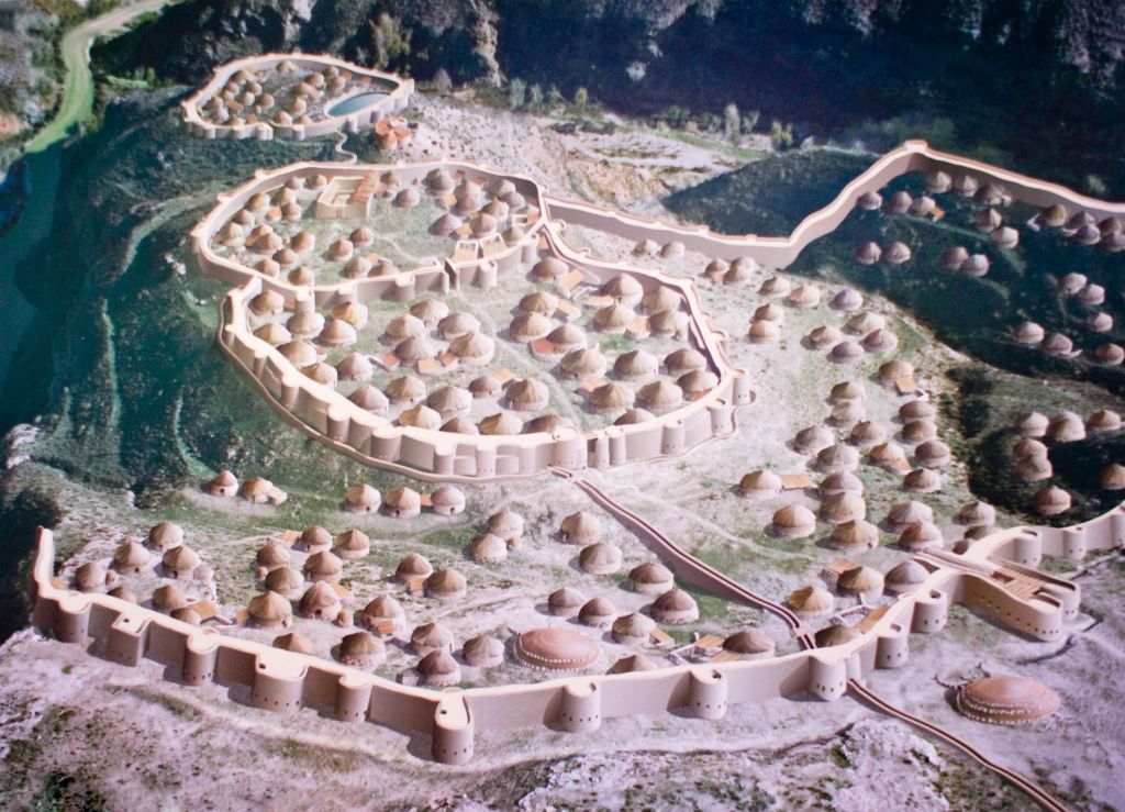
Los Millares is a Chalcolithic occupation site 17 km north of Almería, in the municipality of Santa Fe de Mondújar, Andalucía, Spain. The complex was in use from the fourth millennium BC (c. 3025 BC) to the end of the third millennium BC (c. 2000 BC) and probably supported around 1,000 people. It was discovered in 1891 during the construction of a railway. It was first excavated by Luis Siret in the succeeding years. Excavations are ongoing. Los Millares is the type site of the Chalcolithic Millaran culture.
Text adapted from “Los Millares” on Wikipedia, CC BY-SA 4.0.
Los Millares ranks #881 of 8,134 worldwide in the atlas's castle fame ranking, and #35 of the 602 mapped in Spain. Its Wikipedia articles were opened 6,261 times in the last 60 days, more than 88% of the atlas. 4 more atlas landmarks stand within 25 km. The nearest day-trip guide is Granada, 99 km away. It is one of the 125 landmarks on the atlas's regional map of Andalusia. See how Spain compares in the castle statistics.
View on the interactive castle map →Frequently asked questions
Where is Los Millares?
Los Millares stands in Spain, at 36.96261°, -2.52164°.
How famous is Los Millares?
In this atlas's fame ranking: #881 of 8,134 worldwide, and #35 in Spain. Fame here combines how many Wikipedia language editions cover a landmark with how many people read them.
What is the nearest castle to Los Millares?
Alcazaba y Murallas del Cerro de San Cristóbal, about 14 km away.
More castles in Spain
- Santa Bárbara Castle Spain · 9th century
- Palacio de Cibeles Spain · 20th century
- Palace of Linares Spain · 19th century
- Castro of San Cibrao de Las Spain · 2nd century BC
More ruins
- Toron Lebanon · 12th century
- Landskron Castle Austria · 11th century
- Qal'eh Dokhtar Iran · 3rd century
- Laiuse Castle Estonia · 15th century