Castle
Tamworth Castle
ENG England · 11th century
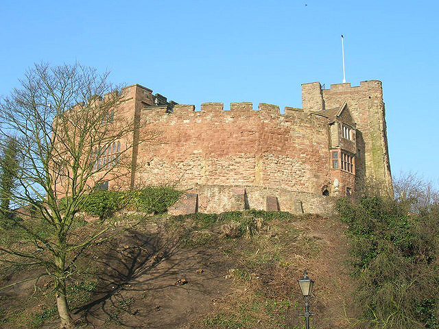
Tamworth Castle, a Grade I listed building, is a Norman castle overlooking the mouth of the River Anker into the Tame in the town of Tamworth in Staffordshire, England. Before boundary changes in 1889, however, the castle was within the edge of Warwickshire while most of the town belonged to Staffordshire.
The site served as a residence of the Mercian kings in Anglo Saxon times, but fell into disuse during the Viking invasions. Refortified by the Normans and later enlarged, the building is today one of the best preserved motte-and-bailey castles in England.
Text adapted from “Tamworth Castle” on Wikipedia, CC BY-SA 4.0.
Tamworth Castle ranks #2,765 of 8,134 worldwide in the atlas's castle fame ranking, and #188 of the 333 mapped in England. Founded 1070, it is older than 89% of the atlas's dated landmarks — one of 325 atlas entries founded in the 11th century. Its Wikipedia articles were opened 2,660 times in the last 60 days, more than 73% of the atlas. 2 more atlas landmarks stand within 25 km. The nearest day-trip guide is Birmingham, 22 km away. See how England compares in the castle statistics.
View on the interactive castle map →Frequently asked questions
Where is Tamworth Castle?
Tamworth Castle stands in England, at 52.6325°, -1.69635°.
When was Tamworth Castle built?
The atlas dates its founding to 1070. Earlier structures may have stood on the site; this is the earliest documented founding year.
How famous is Tamworth Castle?
In this atlas's fame ranking: #2,765 of 8,134 worldwide, and #188 in England. Fame here combines how many Wikipedia language editions cover a landmark with how many people read them.
What is the nearest castle to Tamworth Castle?
Maxstoke Castle, about 15 km away.
More castles in England
- Taunton Castle England · 12th century
- Tiverton Castle England · 11th century
- HM Fort Roughs England · 20th century
- Banna England · 2nd century
More castles
- Methoni Castle Greece · 13th century
- MacLellan's Castle Scotland · 16th century
- Vindobala England
- Craigdarroch Castle Canada · 19th century