Castle
Zilkale
 Turkey · 15th century
- Founded
- c. 1450
- Location
- Çamlıhemşin
- Coordinates
- 40.95925°, 40.96298°
- Open data
- Wikidata Q8071903
- Links
- OpenStreetMap · Wikimedia Commons
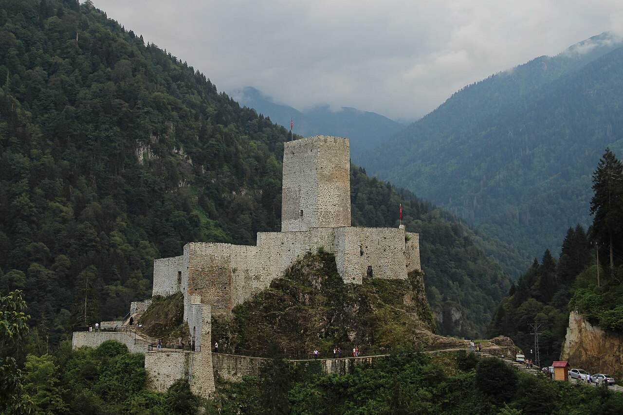
Description
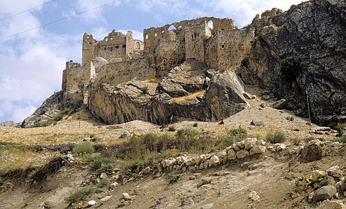
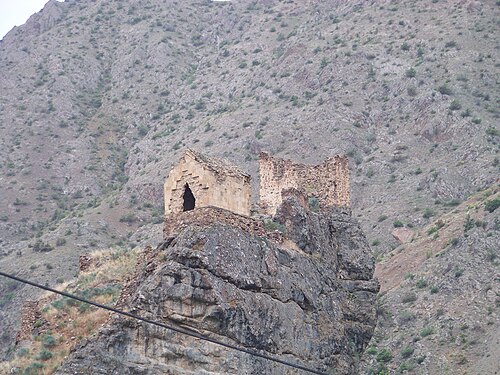
Zilkale is a medieval castle located in the Fırtına Valley (literally "Storm Valley") within the Pontic Mountains, and is one of the most important historical structures in the Çamlıhemşin district of Rize Province, within the Black Sea Region of Turkey.
The castle is built at an altitude of 1,130 m (3,710 ft), and sits at the edge of a cliff overlooking the Fırtına River (Turkish: Fırtına Deresi) approximately 380 m (1,250 ft) below, running at an elevation of 750 m (2,460 ft) southeast of it.
In the 1st-4th centuries AD it was the capital of the Laz principality of Macron-Henochi. The castle consists of the outer walls, middle walls and the inner castle. There are garrison quarters, and a possible chapel and head tower.
Text adapted from “Zilkale” on Wikipedia, CC BY-SA 4.0.
In the rankings
Zilkale ranks #1,716 of 9,902 worldwide in the atlas's castle fame ranking, and #37 of the 130 mapped in Turkey. Founded c. 1450, it is older than 47% of the atlas's dated landmarks, one of 596 atlas entries founded in the 15th century. Its Wikipedia articles were opened 2,859 times in the last 60 days, more than 80% of the atlas. 1 more atlas landmarks stand within 25 km. The nearest day-trip guide is Batumi, 95 km away. See how Turkey compares in the castle statistics.
Castles nearby
- Fortress of Jikha17 km · Turkey
- Rize Castle39 km · Turkey
- Peterek Castle50 km · Turkey
- Kavkasidzeler Castle50 km · Turkey
More castles in Turkey
- Adile Sultan PalaceTurkey · 19th century
- Eski SarayTurkey · 15th century
- ArsameiaTurkey
- Ibrahim Pasha PalaceTurkey · 15th century