Ruin
Breitenstein Castle
🇩🇪 Germany · 13th century
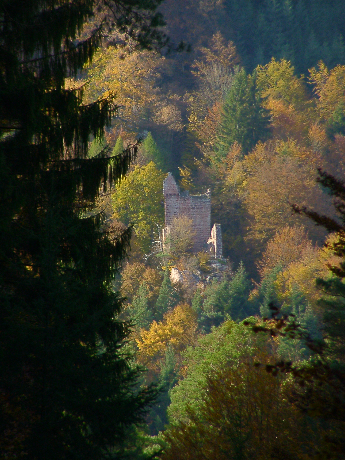
The ruins of Breitenstein Castle (German: Burg Breitenstein) stand on a crag, 220 metres (720 ft) high, on the northern side of the Speyerbach valley in the Palatine Forest in Germany. The castles is 4 kilometres (2.5 mi) east of the village of Elmstein in the county of Bad Dürkheim in the state of Rhineland-Palatinate.
The rock castle was probably built in 1246 by Pope Innocent IV during the unrest over the excommunication of Frederick II. Not until 1257 was it mentioned in the records in connexion with a knight of Kropsberg, castellan of the Breitenstein and Dienstmann of the counts of Leiningen. The knight was named in 1265 as Burkhard of Breitenstein. In 1339 James of Flörsheim was appointed as Burgmann.
After the death of King Rudolph of Habsburg fighting broke out in 1291 between the Habsburgs and their opponents. At that time the counts of Sponheim built a siege castle just a few metres south of Breitenstein Castle. The two sites were separated from one another by a broad neck ditch. The siege castle was mentioned in 1340 as Lower Breitenstein (Nieder-Breitenstein). In that year, Count Walram of Sponheim was found guilty at the royal court in Munich of building a castle on the territory of the prince-bishopric of Speyer without permission and was to hand it over to the Speyer vassal (Lehnsmann), Friedrich Horneck. However, Count Palatine Rudolph II appealed against this decision and announced that the Sponheim lord was his vassal, so that he was allowed to retain the castle.
In 1357, a Burgfrieden treaty was agreed that specified that the larger siege castle would henceforth become the inner ward, and the older, smaller building complex would become the outer ward.
After the castle was mentioned for the last time in 1382, it probably came into the possession of the counts of Leiningen and was likely destroyed in 1470–71 during a feud between its tenant family and the prince-elector, Frederick I – the so-called Electoral Palatine War.
After the ruins had been taken over in 1963 by the Rhineland-Palatinate State Castle Administration, conservation and safety measures were carried out on the walls in 1988 and 1989.
The Late Hohenstaufen inner ward is built on a narrow rock base that, today, is only accessible to experienced climbers. The shield wall, made of rusticated ashlars on all sides, has survived almost to its full height.
Text adapted from “Breitenstein Castle” on Wikipedia, CC BY-SA 4.0.
Breitenstein Castle ranks #6,608 of 8,134 worldwide in the atlas's castle fame ranking, and #492 of the 505 mapped in Germany. Founded 1246, it is older than 73% of the atlas's dated landmarks — one of 861 atlas entries founded in the 13th century. 15 more atlas landmarks stand within 25 km. The nearest day-trip guide is Kaiserslautern, 20 km away. See how Germany compares in the castle statistics.
View on the interactive castle map →Frequently asked questions
Where is Breitenstein Castle?
Breitenstein Castle stands in Germany, at 49.3444°, 7.99861°.
When was Breitenstein Castle built?
The atlas dates its founding to 1246. Earlier structures may have stood on the site; this is the earliest documented founding year.
How famous is Breitenstein Castle?
In this atlas's fame ranking: #6,608 of 8,134 worldwide, and #492 in Germany. Fame here combines how many Wikipedia language editions cover a landmark with how many people read them.
What is the nearest castle to Breitenstein Castle?
Wolfsburg Castle (Neustadt), about 8 km away.
More castles in Germany
- Burg Wildenburg (Eifel) Germany · 13th century
- Campen castle Germany · 13th century
- Burg Wernerseck Germany · 15th century
- Altrathen Castle Germany · 13th century
More ruins
- Grevenburg Germany · 14th century
- Saaleck Castle Germany · 12th century
- Scharfenberg Castle Germany · 12th century
- Scharzfels Castle Germany