 Germany · 12th century
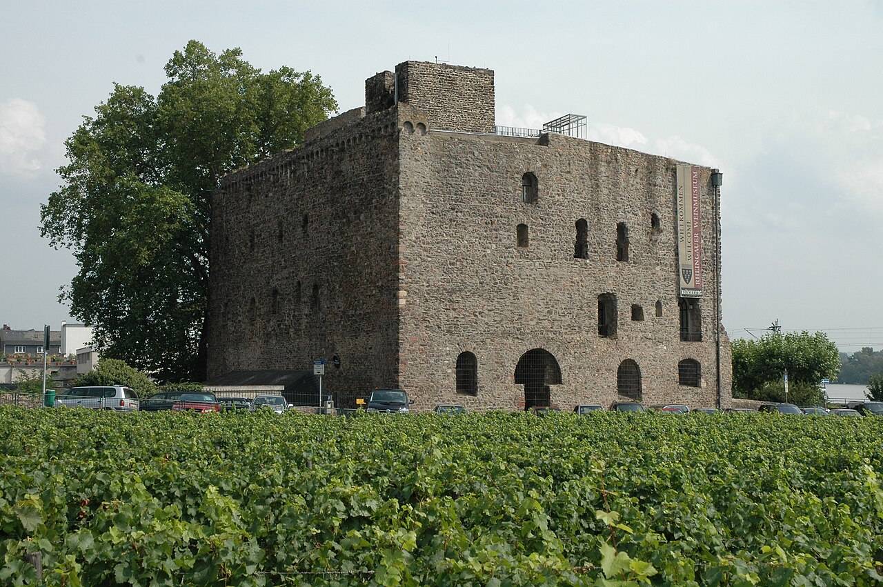
Brömserburg ranks #5,957 of 9,040 worldwide in the atlas's castle fame ranking, and #526 of the 714 mapped in Germany. Founded 1186, it is older than 78% of the atlas's dated landmarks, one of 763 atlas entries founded in the 12th century. 24 more atlas landmarks stand within 25 km. The nearest day-trip guide is Wiesbaden, 26 km away. It is one of the 39 landmarks on the atlas's regional map of the Middle Rhine. It is stop 2 of 32 on the Rhine castle route, Bingen to Koblenz. See how Germany compares in the castle statistics.
The Brömserburg (also called the Niederburg) is a castle located near the banks of the Rhine in the town of Rüdesheim am Rhein in Rheingau-Taunus-Kreis in the German state of Hesse. Its original structure was probably one of the first stone castles in the Rhine Gorge, now a UNESCO World Heritage Site.
The older literature (from the 19th century to the 1980s) suggested the Brömserburg was built on the foundations of a Roman fort. However, no antique building fabric has been confirmed and, in particular, it remains unproven that, as previously assumed, it was a watchtower or the bridgehead of a crossing opposite Bingium (Bingen am Rhein) on the left bank of the Rhine. Since this fort was only built in the 4th century, the thesis is not conclusive, because the Romans had already withdrawn from the right bank of the Rhine after the fall of the limes.
Two construction phases are identifiable. Researchers do not agree on the dating of the first phase, theories range from an early medieval, royal Salhof, dating to before 980, to a mid-12th century castle complex. Examination of an alder post from the foundation of the southeast tower, which is considered to be the oldest part of the castle, showed that the tower could not have been built before 1044 and not after 1216.
The end of the 12th century (1186-1190) was the final period of construction for the second castle.
The shape of the castle, even during its first construction phase, corresponded largely to its present dimensions. It was protected by an enceinte and moats; in those days the Rhine flowed, according to historical engravings, immediately past its southern front — unlike today, where there is a road and wide riverbank zone between the castle and the river. However, the enceinte was thinner (1.6-1.7 metres) and lower than it is today. In the southeast corner there used to be a tower house (donjon), now gone. The tower diagonally opposite, which has survived, also originates from this first phase and served to defend the gate (gate tower) as well as acting as a bergfried. At that time, its height reached up to the upper edge of the present fighting platform.
During the second construction phase, the outer wall was reinforced, cladded with brick and raised.
Text adapted from “Brömserburg” on Wikipedia, CC BY-SA 4.0.
View on the interactive castle map →