Fortress
Ellewoutsdijk Fort
🇳🇱 Netherlands
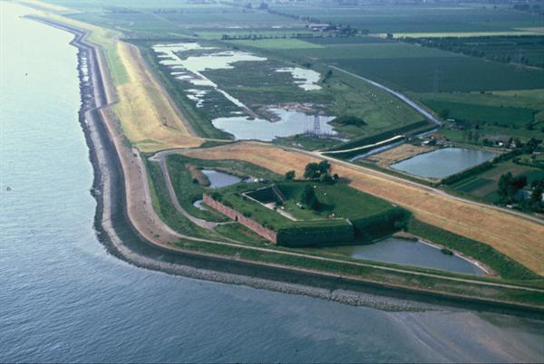
Ellewoutsdijk Fort is a defensive work of 1839. Since 1981 it has been the property of the Vereniging Natuurmonumenten.
In 1830, after the secession of Belgium, the Netherlands began building coastal forts on both banks of the Western Scheldt, in order to gain control over shipping towards Antwerp.
Machine-translated from “Fort Ellewoutsdijk” on the Dutch Wikipedia, CC BY-SA 4.0.
Ellewoutsdijk Fort ranks #7,433 of 8,134 worldwide in the atlas's castle fame ranking, and #173 of the 201 mapped in Netherlands. 2 more atlas landmarks stand within 25 km. The nearest day-trip guide is Middelburg, 19 km away. See how Netherlands compares in the castle statistics.
View on the interactive castle map →Frequently asked questions
Where is Ellewoutsdijk Fort?
Ellewoutsdijk Fort stands in the Netherlands, at 51.38667°, 3.81306°.
How famous is Ellewoutsdijk Fort?
In this atlas's fame ranking: #7,433 of 8,134 worldwide, and #173 in the Netherlands. Fame here combines how many Wikipedia language editions cover a landmark with how many people read them.
What is the nearest castle to Ellewoutsdijk Fort?
Fort Rammekens, about 13 km away.
More castles in the Netherlands
- Fort bij Hinderdam Netherlands
- House Bloemendal Netherlands
- Fort Ronduit Netherlands · 19th century
- Fort Uitermeer Netherlands
More fortresses
- Fort Vijf Sinnen India
- Fort Geldria India · 17th century
- Kldekari Fortress Georgia
- Madikeri Fort India