Ruin
Le Destroit
🇮🇱 Israel · 13th century
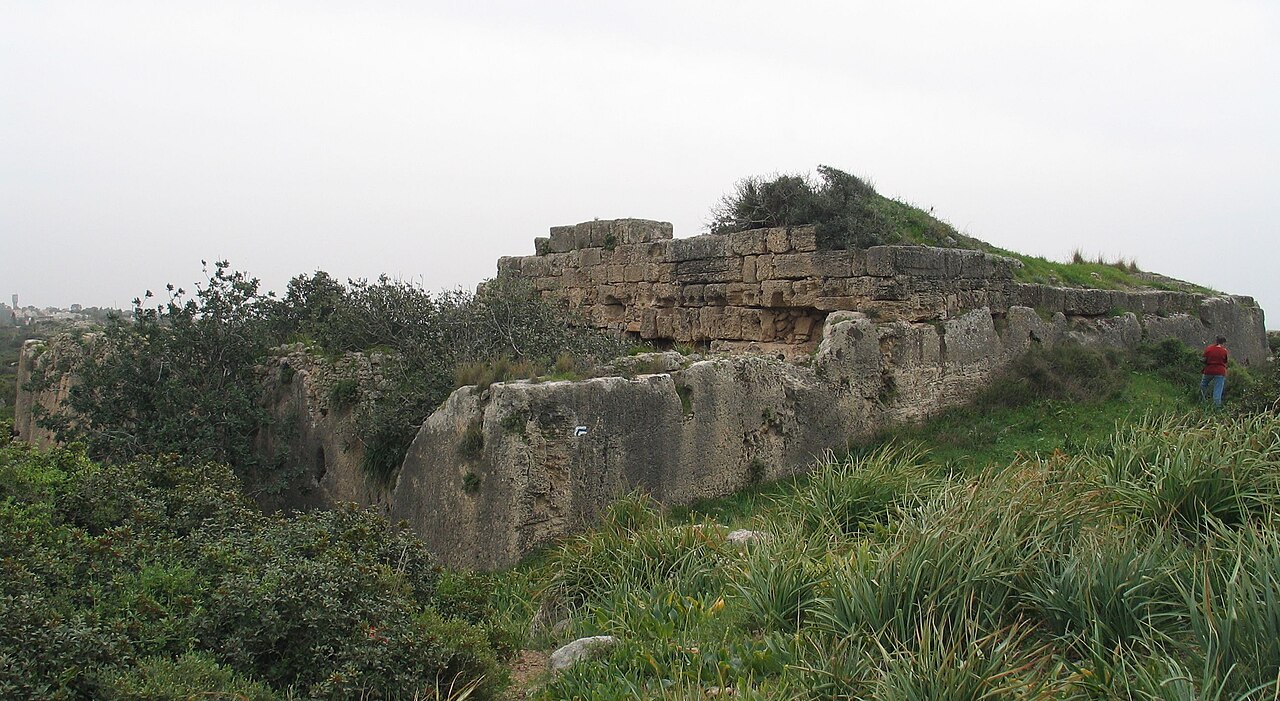
Le Destroit (for alternative names see below) is a ruined medieval fortified road station, built by the Templars of the Crusader Kingdom of Jerusalem in the early 12th century CE, located on the Mediterranean shore near a site where they later built the Chateau Pelerin castle, today close to the modern town of Atlit, Israel.
The Frankish name of the fort was Casel Destreiz and le Destroit, with the Latin variants Destrictum and Petra Incisa. The Arabic name of the site is Khirbat Dustray (alternative spelling Khirbet Dustrey). The Hebrew name is Horvat Qarta.
The Frankish name is derived from Latin (districtus and distringere, consisting of the preposition de and the verb stringere, to tighten) via the Gallo-Romance languages, which retained the meaning of 'narrow' and 'restricted' referring to a connecting way or passage, which resulted in the meaning of 'strait'.
The coastal road near Atlit ran through a narrow passage in the rock, making it an ideal location for robbers to ambush pilgrims and other travelers. In 1103, Baldwin I of Jerusalem was wounded by robbers in the area. The tower fortress, which was situated on a ridge above the pass on the east side of the peninsula at Atlit, was built to protect these travelers.
The army led by King Richard I of England camped at the fortress following the recapture of Acre in 1191. However, when the larger Castrum Perigrinorum was completed in 1218, Le Destroit was dismantled by the Crusaders so that it couldn't be used by the Muslim enemy as a staging ground for an attack on the main castle. Denys Pringle indicates 1220 as the year Destroit was destroyed.
Today the podium-shaped tower base with rock-cut cisterns, the rock-cut yard containing the stables, as well as the moat can still be seen. The remains are cut into the living rock, an aeolian quartz sandstone known in the region as kurkar.
Text adapted from “Le Destroit” on Wikipedia, CC BY-SA 4.0.
Le Destroit ranks #5,649 of 8,134 worldwide in the atlas's castle fame ranking, and #19 of the 25 mapped in Israel. Founded 1217, it is older than 76% of the atlas's dated landmarks — one of 861 atlas entries founded in the 13th century. 2 more atlas landmarks stand within 25 km. The nearest day-trip guide is Haifa, 13 km away. It is one of the 113 landmarks on the atlas's regional map of the Levant. See how Israel compares in the castle statistics.
View on the interactive castle map →Frequently asked questions
Where is Le Destroit?
Le Destroit stands in Israel, at 32.70778°, 34.94611°.
When was Le Destroit built?
The atlas dates its founding to 1217. Earlier structures may have stood on the site; this is the earliest documented founding year.
How famous is Le Destroit?
In this atlas's fame ranking: #5,649 of 8,134 worldwide, and #19 in Israel. Fame here combines how many Wikipedia language editions cover a landmark with how many people read them.
What is the nearest castle to Le Destroit?
Château Pèlerin, about 1 km away.
More castles in Israel
- Hunin Fortress Israel
- Birya Fortress Israel · 20th century
- King's Castle Israel
- Caco Israel · 12th century
More ruins
- Harzburg Germany · 11th century
- Are Castle Germany · 11th century
- Château de Robert-le-Diable France · 10th century
- Dunboy Castle Ireland · 15th century