Ruin
Lilleborg
🇩🇰 Denmark · 12th century
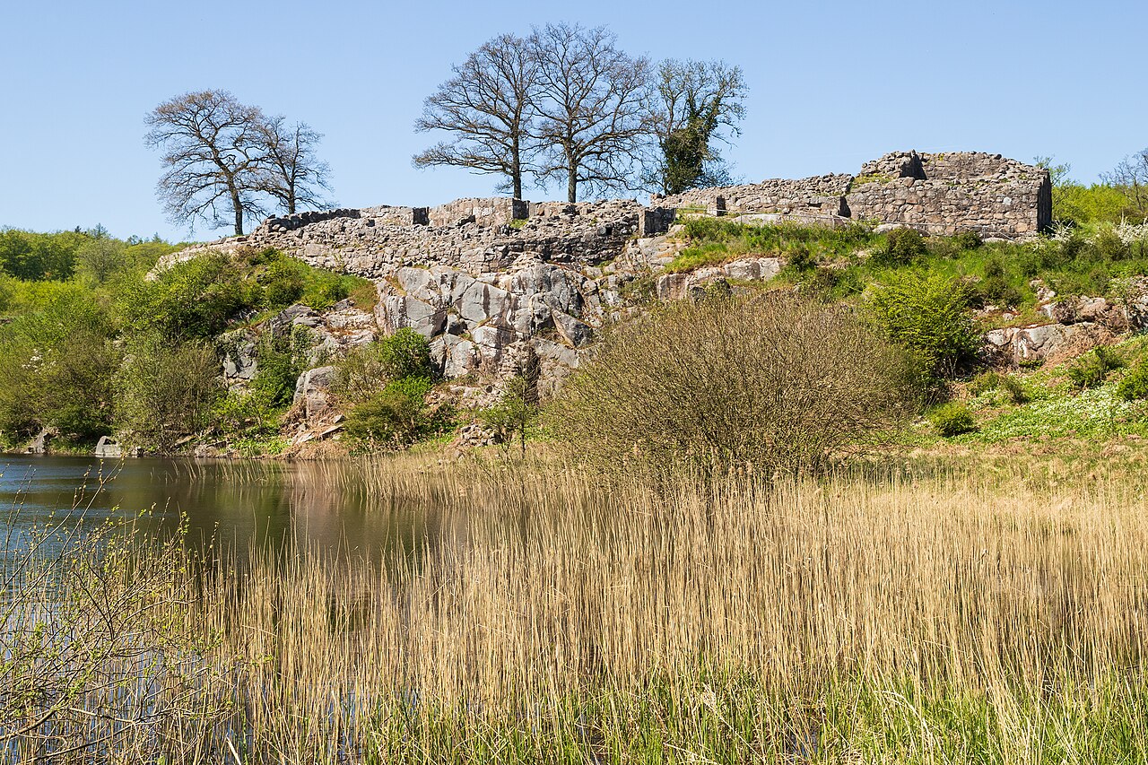
Lilleborg is a ruined castle in the Almindingen forest in the centre of the Danish island of Bornholm. It is situated close to the main road from Rønne to Svaneke. Of the Danish fortresses built in the 12th century, Lilleborg most closely resembles those of Saxon architectural style.
In 2025, researchers from the National Museum of Denmark and Bornholms Museum concluded that some sort of fortification was already located on the site in the 4th century. Remains of the earlier Iron Age fortification were discovered in 2010.
Text adapted from “Lilleborg, Bornholm” on Wikipedia, CC BY-SA 4.0.
Lilleborg ranks #4,588 of 8,134 worldwide in the atlas's castle fame ranking, and #49 of the 53 mapped in Denmark. Founded c. 1190, it is older than 79% of the atlas's dated landmarks — one of 564 atlas entries founded in the 12th century. 2 more atlas landmarks stand within 25 km. See how Denmark compares in the castle statistics.
View on the interactive castle map →Frequently asked questions
Where is Lilleborg?
Lilleborg stands in Denmark, at 55.11889°, 14.89698°.
When was Lilleborg built?
The atlas dates its founding to c. 1190. Earlier structures may have stood on the site; this is the earliest documented founding year.
How famous is Lilleborg?
In this atlas's fame ranking: #4,588 of 8,134 worldwide, and #49 in Denmark. Fame here combines how many Wikipedia language editions cover a landmark with how many people read them.
What is the nearest castle to Lilleborg?
Gamleborg, about 1 km away.
More castles in Denmark
- Nordborg Castle Denmark
- Voergaard Castle Denmark · 16th century
- Riberhus Denmark
- Søborg Castle Denmark · 12th century
More ruins
- Aydos Castle Turkey · 13th century
- Insterburg Castle Russia · 14th century
- Cullahill Castle Ireland · 15th century
- Borsh Fortress Albania