 Greece · 14th century BC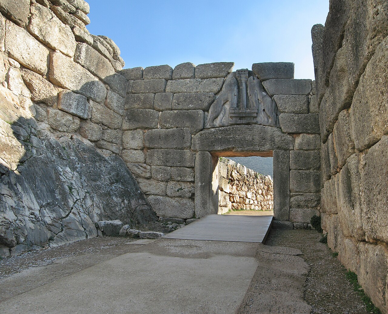
Mycenae ( my-SEE-nee; Ancient Greek: Μυκῆναι or Μυκήνη, Mykē̂nai or Mykḗnē) is an archaeological site near Mykines in Argolis, north-eastern Peloponnese, Greece. It is located about 120 kilometres (75 miles) south-west of Athens; 11 kilometres (7 miles) north of Argos; and 48 kilometres (30 miles) south of Corinth. The site is 19 kilometres (12 miles) inland from the Saronic Gulf and built upon a hill rising 274 metres (899 feet) above sea level.
In the second millennium BC, Mycenae was one of the major centres of Greek civilization—a military stronghold which dominated much of southern Greece, Crete, the Cyclades and parts of southwest Anatolia. The period of Greek history from about 1600 BC to about 1100 BC is called Mycenaean in reference to Mycenae. At its peak in 1350 BC, the citadel and lower town had a population of 30,000 and an area of 32 hectares (79 acres).
The first correct identification of Mycenae in modern literature was in 1700, during a survey conducted by the Venetian engineer Francesco Vandeyk on behalf of Francesco Grimani, the Provveditore Generale of the Kingdom of the Morea. Vandeyk used Pausanias's description of the Lion Gate to identify the ruins of Mycenae.
In 1999 the archeological site of Mycenae was added to the UNESCO World Heritage List, along with the nearby site of Tiryns, citing its historical importance as the center of the Mycenaean civilization, its outstanding architecture and its testimony to the development of Ancient Greek civilization. Noteworthy architecture includes the Lion Gate, the Treasury of Atreus and the walls of Mycenae and Tiryns.
These sites are strongly connected to the Homeric epics. The earliest examples of the Greek language are also visible at Mycenae and Tiryn, preserved on Linear B tablets.
Text adapted from “Mycenae” on Wikipedia, CC BY-SA 4.0.
Mycenae ranks #4 of 9,035 worldwide in the atlas's castle fame ranking, and #1 of the 133 mapped in Greece. Founded c. 1350 BC, it is older than 99% of the atlas's dated landmarks, one of 5 atlas entries founded in the 14th century BC. Its Wikipedia articles were opened 456,682 times in the last 60 days, more than 99% of the atlas. Wikidata records about 500,000 visitors in 2018. 7 more atlas landmarks stand within 25 km. The nearest day-trip guide is Athens, 90 km away. It is one of the 34 landmarks on the atlas's regional map of the Peloponnese. See how Greece compares in the castle statistics.
View on the interactive castle map →