 Egypt · 12th century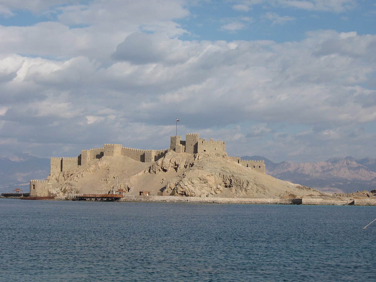
Pharaoh's Island (Arabic: جَزِيْرَةُ فِرعَون Jazīratu Firʽawn), whose current popular name is Coral Island, is a small island in the northern Gulf of Aqaba some 250 metres (820 ft) east off the shore of Egypt's eastern Sinai Peninsula. Some scholars identify this island port with biblical Ezion-Geber. The island holds the ruins of a medieval fortress, officially known as Saladin's Castle.
In spite of its second name, "Coral Island", Jazirat Fir'aun consists of solid granite. It stands some 13 kilometres (8.1 mi) southwest of modern Eilat.
With a length of 350 metres (380 yd) from north to south, and 170 metres (190 yd) at its widest point, the island covers an area of 3.9 hectares (9.6 acres) and is separated from the shore west of it by a shallow lagoon, about 250 metres (270 yd) wide, only accessible by boat at high tide, which served in the 13th century as a sheltered anchorage. Additionally, the island has a harbour of 35 by 65 metres (38 yd × 71 yd) whose now very heavily silted basin offered even more protection. It has been noted by some scholars that the harbour was created artificially and corresponds to the mainly Phoenician cothon type.
The island and its harbour stood at the junction of sea and land routes, the former connecting to Southern Arabia and East Africa, and the latter leading north to Syria and across the Sinai to Egypt.
There have been many attempts to identify biblical Ezion-Geber and Eloth, with scholars like Beno Rothenberg in 1967, A. Flinder in 1977 and 1989, and Avner Raban in 1997 offering arguments in favour of Pharaoh's Island being the port of Ezion-Geber.
Midianite and Negev pottery were found on the island, which are best known from the 13th-12th centuries BCE (end of the Bronze Age and beginning of the Iron Age) and the Iron Age, respectively. A casemate wall with towers that surrounds the island at shore level, including the harbour, could not be positively dated yet. During a dig in one of its rooms, two sherds of Negev pottery were found in the petrified debris, but not at floor level, which excludes them as a safe indicator of the wall's age.
Text adapted from “Pharaoh's Island” on Wikipedia, CC BY-SA 4.0.
Pharaoh's Island ranks #870 of 9,079 worldwide in the atlas's castle fame ranking, and #7 of the 37 mapped in Egypt. Founded c. 1150, it is older than 80% of the atlas's dated landmarks — one of 756 atlas entries founded in the 12th century. Its Wikipedia articles were opened 3,740 times in the last 60 days, more than 82% of the atlas. 2 more atlas landmarks stand within 25 km. See how Egypt compares in the castle statistics.
View on the interactive castle map →