 Israel · 12th century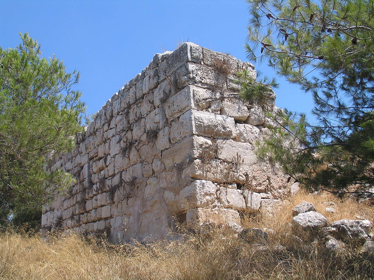
Qula (Arabic: قولة) was a Palestinian village in the Ramle Subdistrict of Mandatory Palestine, located 15 km northeast of Ramla. Its residents had their origins in Jimzu, Ammuriya and other places.
Palestinian commander Hasan Salama, and his son Ali Hassan Salameh (1940-1979) were from Qula. The village was depopulated during the 1948 Arab-Israeli War.
The name Qula is of Aramaic origins. it is first documented in Crusader form as: Chola or Cola.
During the twelfth century the Hospitallers established an administrative and collection centre in the village, comprising a tower and a vaulted structure.
In 1596, Qula was part of the Ottoman Empire, nahiya (subdistrict) of al-Ramla under the Liwa of Gaza, with a population 69 Muslim households; an estimated population of 380. The villagers paid taxes on goats and beehives, and a press that was used for processing either olives or grapes, in addition of a fixed sum: a total of 6,650 akçe.
In 1838, Kuleh was among the villages Edward Robinson noted from the top of the White Mosque, Ramla.
In 1870, the French explorer Victor Guérin noted: "This village, located on a rocky hill, obviously replaced a small town or ancient village. There is a large building now divided into several private dwellings, built either by the Muslims or by the Christians at the time of the Crusades, with cut stones removed from old buildings.
Besides, there is another construction, less extensive than the preceding one, but the lower courses of which are formed with much larger blocks, either flattened or cut into bosses, still serving at present as a tower, or defense tower.
All the upper part is of a much more recent date. A small mosque is similarly built with materials of which at least half seem ancient. At the door in particular of this sanctuary the feet are decorated with moldings that seem to be pointing to a time before the Muslim invasion. Finally, near the village, a birket, (a pond), 18 paces by 12 wide, is probably not the work of the Arabs. It is partly dug in the rock and partly constructed of large polygonal blocks coated with thick cement."
An Ottoman village list from about the same year, 1870, showed Kula with a population of 159, in 38 houses, though the population count included men, only.
Text adapted from “Qula” on Wikipedia, CC BY-SA 4.0.
Qula ranks #2,242 of 9,079 worldwide in the atlas's castle fame ranking, and #10 of the 23 mapped in Israel. Founded c. 1150, it is older than 80% of the atlas's dated landmarks — one of 756 atlas entries founded in the 12th century. Its Wikipedia articles were opened 1,467 times in the last 60 days, more than 61% of the atlas. 2 more atlas landmarks stand within 25 km. The nearest day-trip guide is Tel Aviv, 17 km away. It is one of the 106 landmarks on the atlas's regional map of the Levant. See how Israel compares in the castle statistics.
View on the interactive castle map →