Castlemap

Castle route

Edward I’s ring of iron

5 castles and 3 ruins along about 175 km, Flint to Beaumaris — every stop mapped, photographed and in travel order.

After conquering Gwynedd in 1282 Edward I built a chain of castles around the north Welsh coast to hold it, and it worked: the ring was never broken. Most were designed by James of St George, the Savoyard master mason, and four of them — Conwy, Caernarfon, Harlech and Beaumaris — are together a UNESCO World Heritage Site. Beaumaris, begun in 1295, was never finished; the money ran out and its towers still stand at half height.

What this atlas maps on Edward I’s ring of iron

Every stop is named in the route itself rather than chosen by a radius, all of them 13th century.

The best known is Caernarfon Castle, ranked 149 of the 8,133 landmarks in the atlas by Wikipedia presence and real readership. The oldest is Criccieth Castle, founded 1230.

The route runs through Wales. The same ground, without the itinerary: Castles in North Wales.

Travelling it

The A55 runs along the coast past Flint, Rhuddlan, Conwy and the Anglesey bridge; Harlech and Criccieth are on the far side of Snowdonia, an hour south. The North Wales Coast line reaches Flint, Rhuddlan, Conwy and Bangor by train, and the Cambrian Coast line Harlech and Criccieth.

Day-trip guides for the towns and cities along it: Liverpool · Wrexham.

See the route on the map →
The stops, in order

Distances are straight-line, accumulated in the order shown. The atlas holds coordinates, not road geometry, so the road will always be longer.

  1. 1
    Flint Castle

    Castle · 13th century

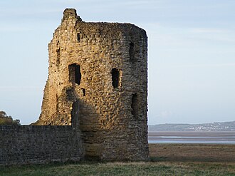
    Flint Castle in Flint, Flintshire, was the first of a series of castles built during King Edward I's campaign to conquer Wales.

    start
  2. 2
    Rhuddlan Castle

    Ruin · 13th century

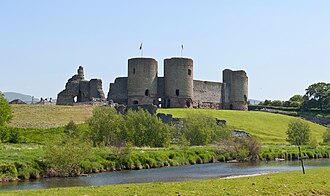
    Rhuddlan Castle is a castle located in Rhuddlan, Denbighshire, Wales.

    23 km
  3. 3
    Denbigh Castle

    Ruin · 13th century

    Denbigh Castle and town walls were built to control the lordship of Denbigh after the Conquest of Wales by Edward I of England in…

    35 km
  4. 4
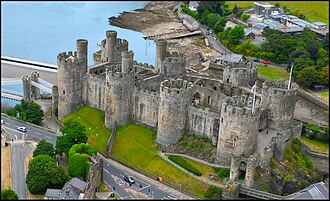
    Conwy Castle

    Castle · 13th century

    Conwy Castle is a fortification in Conwy, located in North Wales. It was built by Edward I, during his conquest of Wales, between…

    64 km
  5. 5
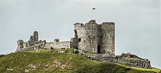
    Criccieth Castle

    Ruin · 13th century

    Criccieth Castle is a ruined thirteenth-century castle in Criccieth, Gwynedd, Wales.

    113 km
  6. 6
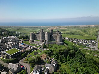
    Harlech Castle

    Castle · 13th century

    Harlech Castle in Harlech, Gwynedd, Wales, is a Grade I listed medieval fortification built onto a rocky knoll close to the Irish…

    123 km
  7. 7
    Caernarfon Castle

    Castle · 13th century

    Caernarfon Castle is a medieval fortress in Gwynedd, north-west Wales.

    156 km
  8. 8
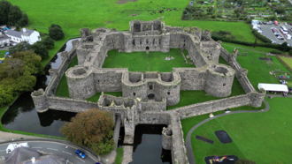
    Beaumaris Castle

    Castle · 13th century

    Beaumaris Castle, in Beaumaris, Anglesey, Wales, was built as part of Edward I's campaign to conquer north Wales after 1282.

    175 km

Common questions

How many castles are on Edward I’s ring of iron?

This atlas maps 8 on it — 5 castles and 3 ruins.

How long is Edward I’s ring of iron?

The 8 stops span about 175 km in the order given, measured straight-line. Roads add to that.

Which is the best-known castle on Edward I’s ring of iron?

Caernarfon Castle — ranked 149 of 8,133 in the atlas by how many Wikipedia editions write about it and how many people read them.

Which is the oldest?

Criccieth Castle — founded 1230.