 Wales · 13th century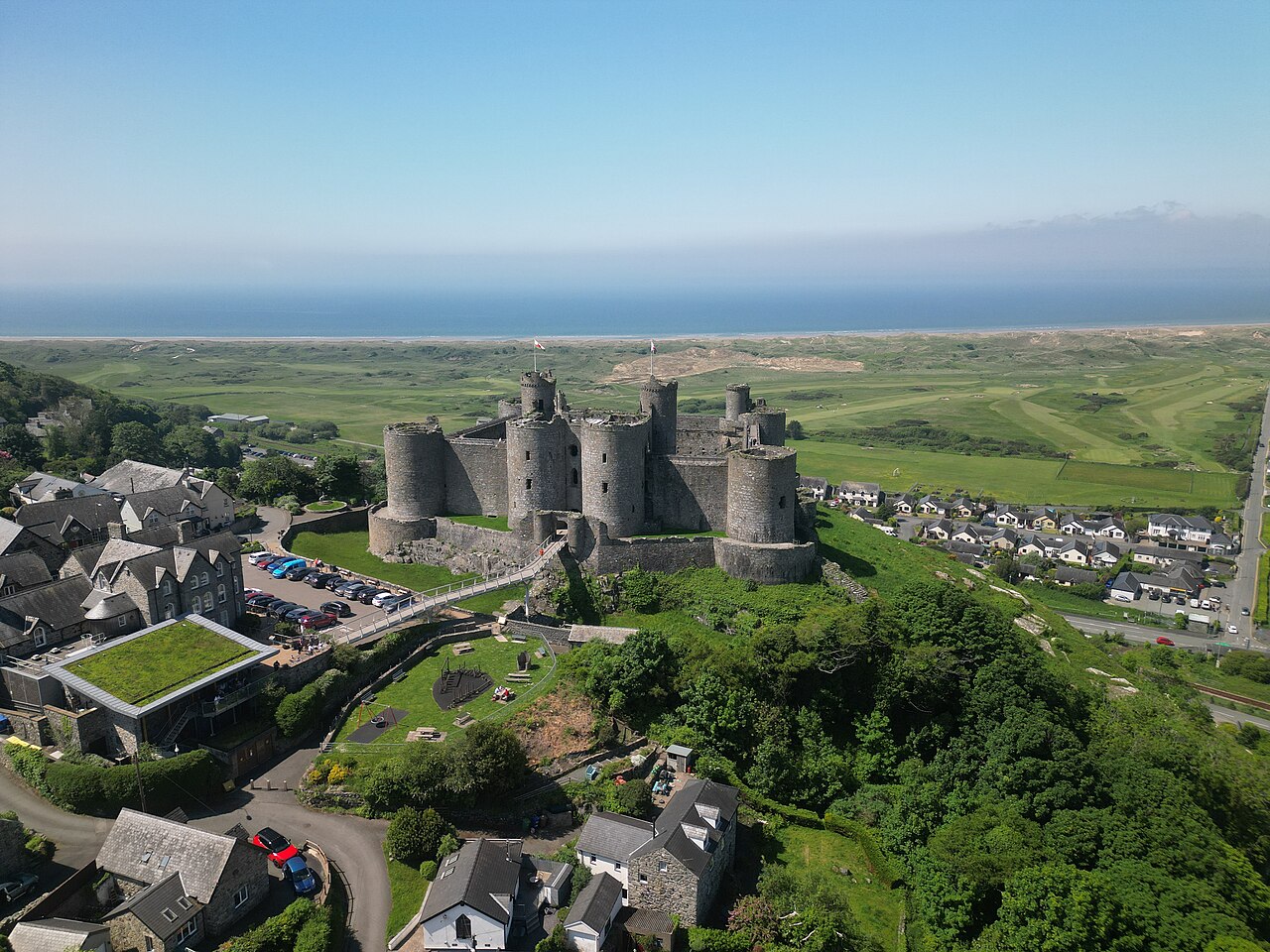
Harlech Castle (Welsh: Castell Harlech; Welsh pronunciation: [kastɛɬ ˈharlɛχ]) in Harlech, Gwynedd, Wales, is a Grade I listed medieval fortification built onto a rocky knoll close to the Irish Sea. It was built by Edward I during his invasion of Wales between 1282 and 1289 at the relatively modest cost of £8,190. Over the next few centuries, the castle played an important part in several wars, withstanding the siege of Madog ap Llywelyn between 1294 and 1295, but falling to Prince Owain Glyndŵr in 1404. It then became Glyndŵr's residence and military headquarters for the remainder of the uprising until being recaptured by English forces in 1409.
During the 15th-century Wars of the Roses, Harlech was held by the Lancastrians for seven years, before Yorkist troops forced its surrender in 1468, a siege memorialised in the song "Men of Harlech". Following the outbreak of the English Civil War in 1642, the castle was held by forces loyal to Charles I, holding out until 1647 when it became the last fortification to surrender to the Parliamentary armies. In the 21st century the ruined castle is managed by Cadw, the Welsh Government's historic environment service, as a tourist attraction, and since 2024 under its Welsh name only.
UNESCO considers Harlech, with three others at Beaumaris, Conwy and Caernarfon, to be one of "the finest examples of late 13th century and early 14th century military architecture in Europe", and it is classed as a World Heritage Site. The fortification is built of local stone and concentric in design, featuring a massive gatehouse that probably once provided high-status accommodation for the castle constable and visiting dignitaries.
Text adapted from “Harlech Castle” on Wikipedia, CC BY-SA 4.0.
Harlech Castle ranks #331 of 9,079 worldwide in the atlas's castle fame ranking, and #6 of the 107 mapped in Wales. Founded 1283, it is older than 64% of the atlas's dated landmarks — one of 1080 atlas entries founded in the 13th century. Its Wikipedia articles were opened 11,412 times in the last 60 days, more than 95% of the atlas. 4 more atlas landmarks stand within 25 km. The nearest day-trip guide is Wrexham, 78 km away. It is one of the 27 landmarks on the atlas's regional map of North Wales. It is stop 6 of 8 on Edward I’s ring of iron, Flint to Beaumaris. See how Wales compares in the castle statistics.
View on the interactive castle map →