 Germany · 18th century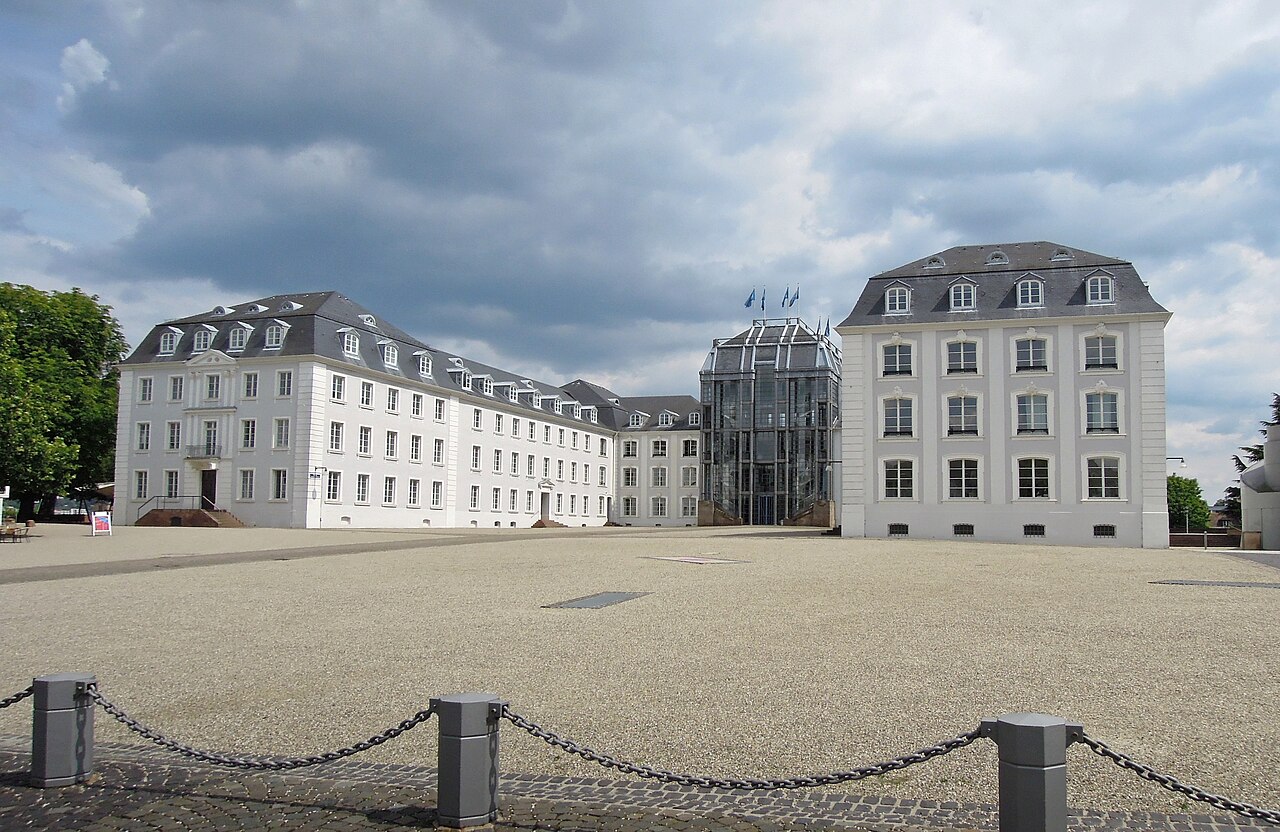
Saarbrücken Castle (German: Schloss Saarbrücken) is a Baroque château in Saarbrücken, the capital of Saarland. It is located in the district of Alt-Saarbrücken on the left bank of the Saar. Earlier, a medieval castle and a Renaissance castle stood on the same site.
Historical sources from the year 999, reported the existence of an imperial Castell Sarabruca. In 1009, it is named as Veste Sarebrugka. A document from 1065 mentions that Duke Frederick of Lower Lorraine received the castle as a fief from the King. Later, Emperor Henry IV gave the castle to Frederick's brother, Count Adalbero III of Luxembourg, who was Bishop of Metz.
In 1168, the castle was destroyed by Count Symon, on the orders of Emperor Frederick I. Later archives mention a Castel and Bourg on 2 July 1277.
A deed from 1485 reports that Count John II .... in 1459, because of the war, began to fortify and guard the two cities. In 1463, John added a bulwark and a drawbridge across the moat that separated the castle from the city.
Johann Andreae, the chronicler of the Counts of Nassau-Saarbrücken, reports that Count Philip IV built a summer residence in Saarbrücken and provides a sketch of appearance of the medieval castle. It had a trapezoid-shaped inner court, surrounded by buildings of different widths. There was a tower on the western side. The bailey on the Saar side was enclosed on the northwest and southeast by buildings. The summer house had been designed by architect Christmann Stromeyer from the Electorate of the Palatinate and stood on the southeastern edge of the cliff . The castle was surrounded in the north-east by the Saar Rocks and the river Saar, on the east by a ditch and on the south and southwest by the bulwark and a moat. The entrance was the drawbridge opposite the large tower. At the southern end of the garden was a red tower and at the northern corner a small round tower.
Drawings by Hienrich Höers provide a reliable and authentic image of the topography of the palace complex in the 17th century. It shows a four-winged structure inside a curtain wall with differently shaped bastions. Defensive structures including towers, walls, gatehouses and trenches followed the topography of the Saar rock. The rampart was strengthened with triangular corner bastions.
Text adapted from “Saarbrücken Castle” on Wikipedia, CC BY-SA 4.0.
Saarbrücken Castle ranks #2,938 of 9,035 worldwide in the atlas's castle fame ranking, and #232 of the 709 mapped in Germany. Founded c. 1750, it is older than 16% of the atlas's dated landmarks, one of 685 atlas entries founded in the 18th century. Its Wikipedia articles were opened 1,961 times in the last 60 days, more than 69% of the atlas. 2 more atlas landmarks stand within 25 km. The nearest day-trip guide is Saarbrücken, 1 km away. See how Germany compares in the castle statistics.
View on the interactive castle map →