 England · 16th century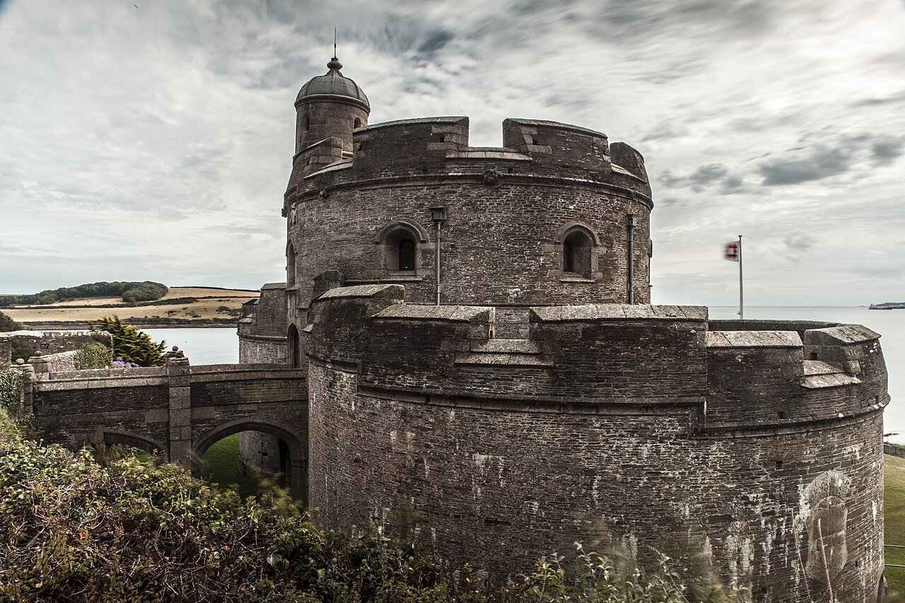
St Mawes Castle (Cornish: Kastel Lannvowsedh) is an artillery fort constructed by Henry VIII near Falmouth, Cornwall, between 1540 and 1542. It formed part of the King's Device programme to protect against invasion from France and the Holy Roman Empire, and defended the Carrick Roads waterway at the mouth of the River Fal. The castle was built under the direction of Thomas Treffry to a clover leaf design, with a four-storey central tower and three protruding, round bastions that formed gun platforms. It was initially armed with 19 artillery pieces, intended for use against enemy shipping, operating in partnership with its sister castle of Pendennis on the other side of the estuary. During the English Civil War, St Mawes was held by Royalist supporters of King Charles I, but surrendered to a Parliamentary army in 1646 in the final phase of the conflict.
The castle continued in use as a fort through the 18th and 19th centuries. In the early 1850s, fears of a fresh conflict with France, combined with changes in military technology, led to the redevelopment of the fortification. The out-dated Henrician castle was turned into a barracks and substantial gun batteries were constructed beneath it, equipped with the latest naval artillery. In the 1880s and 1890s an electrically operated minefield was laid across the River Fal, operated from St Mawes and Pendennis, and new, quick-firing guns were installed at St Mawes to support these defences. After 1905, however, St Mawes' guns were removed, and between 1920 and 1939 it was run by the state as a tourist attraction.
Brought back into service in the Second World War, naval artillery and an anti-aircraft gun were installed at the castle to defend against the risk of German attack. With the end of the war, St Mawes again returned to use as a tourist attraction. In the 21st century, the castle is operated by English Heritage.
Text adapted from “St Mawes Castle” on Wikipedia, CC BY-SA 4.0.
St Mawes Castle ranks #2,533 of 9,079 worldwide in the atlas's castle fame ranking, and #171 of the 360 mapped in England. Founded 1539, it is older than 40% of the atlas's dated landmarks — one of 891 atlas entries founded in the 16th century. Its Wikipedia articles were opened 1,663 times in the last 60 days, more than 64% of the atlas. 3 more atlas landmarks stand within 25 km. See how England compares in the castle statistics.
View on the interactive castle map →