Castle
Stanecastle
SCT Scotland · 14th century
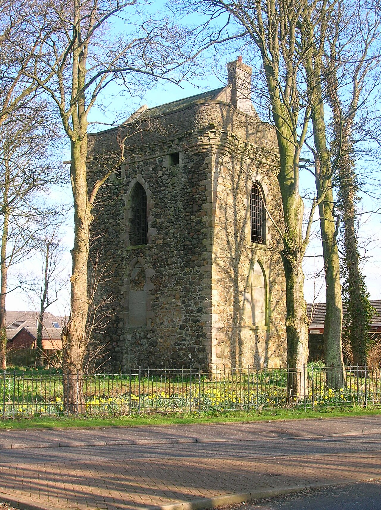
Stanecastle was a medieval barony and estate in North Ayrshire, Scotland, first mentioned in 1363 and now part of the Irvine New Town project. Its nearest neighbours are Bourtreehill and Girdle Toll.
The early history of Stanecastle is obscure but it was once believed that the "stane" (stone, Norse: steinn) prefix referred to older Roman structures. However, it is now known that stone building in Scotland and Ayrshire was not restricted to the Roman and Norman periods, and need not suggest any such Roman origins.
The ancient name of the barony was the "Barony of Stane (Stone)". A ley tunnel is said to run from Seagate Castle in Irvine to Stane Castle.
William Fraunces de le Stane held lands which included a chapel dedicated to Saint Bridget. The chapel stood on the muir near to Stane on the right bank of the Annick Water.
At the core of the medieval estate may have been an older medieval nunnery or convent and evidence has been discovered (and long lost under a turnpike road) of a small medieval chapel, probably dedicated to St. Bridget and, as was the norm, had its own graveyard (also long buried underneath the road). In the 17th century the twenty shilling lands of old extent called Brydskirk are recorded, but with no mention of a chapel.
The original castle was built circa 1417 by the Francis family, who also held land at Sprouston near Kelso. The barony passed by marriage to the Montgomerys of Greenfield.
In the middle-ages, Stanecastle gave way to the ever-expanding Eglinton Empire and William Francis of Stane passed his estate on to the Earls of Eglinton in the 15th century. Campbell states that the present castle was built in 1520 by Montgomerie of Greenfield, a cadet branch.
In 1750 Alexander, 10th Earl of Eglinton, repaired the castle, converting it into a folly. The four open and four closed pointed windows were constructed for appearance only at this time and on the west side an armorial panel stone with the Earl of Eglinton's arms was put in place. Through some mistake this panel was said to have been placed upside down; however, the shield is actually the right way up. The apparent fault is that the signet rings and fleur de lis inside are upside down. Another error occurs on a similar-sized armorial panel now preserved in the quadrangle of Eglinton Country Park in which the symbols are in the wrong quarters.
Text adapted from “Stanecastle” on Wikipedia, CC BY-SA 4.0.
Stanecastle ranks #6,834 of 8,764 worldwide in the atlas's castle fame ranking, and #201 of the 207 mapped in Scotland. Founded 1363, it is older than 57% of the atlas's dated landmarks — one of 649 atlas entries founded in the 14th century. 7 more atlas landmarks stand within 25 km. The nearest day-trip guide is Glasgow, 36 km away. See how Scotland compares in the castle statistics.
View on the interactive castle map →Frequently asked questions
Where is Stanecastle?
Stanecastle stands in Scotland, at 55.6249°, -4.6418°.
When was Stanecastle built?
The atlas dates its founding to 1363. Earlier structures may have stood on the site; this is the earliest documented founding year.
How famous is Stanecastle?
In this atlas's fame ranking: #6,834 of 8,764 worldwide, and #201 in Scotland. Fame here combines how many Wikipedia language editions cover a landmark with how many people read them.
What is the nearest castle to Stanecastle?
Eglinton Castle, about 3 km away.
More castles in Scotland
- Strome Castle Scotland
- Sundrum Castle Scotland · 14th century
- Thomaston Castle Scotland · 13th century
- Balmoral Castle Scotland · 14th century
More castles
- West Cowes Castle England · 16th century
- Schloss Gödens Germany · 17th century
- Castle of Somló Hungary
- Sárvár Castle Hungary · 16th century