Ruin
Claxton Castle
ENG England
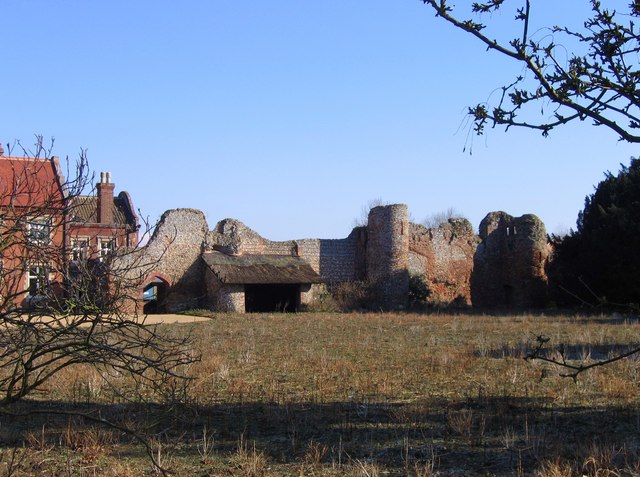
Claxton Castle in the village of Claxton, Norfolk, is a ruined brick castle some 13 km southeast of Norwich.
Sir William de Kerdeston and his son were given licence to crenellate the castle in 1340 and 1376 respectively, the latter licence necessary due to Kerdeston's death before completion of the castle. It was largely demolished in the 17th century to build Claxton Hall. The castle ruins consist of a long wall and three towers with various staircases and archways. Earthworks indicate an outer moat and causeway dating from medieval times. It is a Grade II* listed building first listed in 1951 and is a scheduled monument.
Text adapted from “Claxton Castle” on Wikipedia, CC BY-SA 4.0.
Claxton Castle ranks #5,438 of 8,134 worldwide in the atlas's castle fame ranking, and #325 of the 333 mapped in England. 5 more atlas landmarks stand within 25 km. The nearest day-trip guide is Colchester, 85 km away. See how England compares in the castle statistics.
View on the interactive castle map →Frequently asked questions
Where is Claxton Castle?
Claxton Castle stands in England, at 52.5816°, 1.44587°.
How famous is Claxton Castle?
In this atlas's fame ranking: #5,438 of 8,134 worldwide, and #325 in England. Fame here combines how many Wikipedia language editions cover a landmark with how many people read them.
What is the nearest castle to Claxton Castle?
Norwich Castle, about 11 km away.
More castles in England
- Baconsthorpe Castle England · 15th century
- Bedford Castle England · 11th century
- Northampton Castle England · 11th century
- Bowes Castle England
More ruins
- Dunscaith Castle Scotland
- Bristol Castle England · 11th century
- Rufus Castle England · 12th century
- Eynsford Castle England · 11th century