 Armenia · 16th century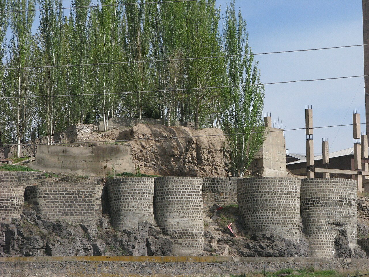
Erivan Fortress or Yerevan Fortress (Armenian: Երևանի բերդը; Yerevani berdë; Persian: قلعه ایروان, Ghaleh-ye Iravân; Russian: Эриванская крепость E'rivanskaya krepost') was a 16th-century fortress in Yerevan.
The fortress was built during the Ottoman rule in 1582–83 by Serdar Ferhat Pasha. The fortress was destroyed by an earthquake in 1679. After the earthquake, the Safavid governor of Erivan, Zal Khan, asked the Shah for help to rebuild Erivan, including the fortress and the Palace of the Sardars.
In 1853, the fortress was ruined by another earthquake. In 1865 the territory of the fortress was purchased by Nerses Tairyants, a merchant of the first guild. Later in 1880s, Tairyants built a brandy factory in the northern part of the fortress.
The fortress was completely demolished in 1930s during the Soviet rule, although some parts of the defensive walls still remain.
The Erivan Fortress was considered to be a small town separate from the city. It was separated from the city with large and unwrought space. The fortress was rectangular with a perimeter of about 1,200 metres (4,000 ft). It was walled on three sides; on the fourth (western) it was flanked by the Hrazdan River gorge. The gorge on the north-western part of the fortress had a depth of 300 sazhen (640 meters). As it was considered inaccessible it was not walled. The earth mound was considered as a wall.
The Erivan Fortress had three gateways on its double line battlements: Tabriz, Shirvan and Korpu. The walls had towers like old eastern castles. Each wall had an iron gate, and each one had its guard. The garrison had about 2,000 soldiers. There were 800 houses inside the fortress. The permanent residents of the fortress were local Muslims only. Although Armenians were allowed to work in the markets during the day, they had to lock up and return to their homes in Shahar (the main town) at night.
The palace was in the north-western part of the fortress. The palace hanged on the Hrazdan gorge. It was a square wide building with many sections. The harem was one of the biggest sections, it was 61 metres (200 ft) long and 38 metres (125 ft) wide. It was divided into many rooms and corridors. This palace was built in 1798 during the reign of Huseyn-Ali khan's son, Mahmud.
All palaces built previously had been destroyed whenever the khans built a new one.
Text adapted from “Erivan Fortress” on Wikipedia, CC BY-SA 4.0.
Erivan Fortress ranks #1,443 of 9,079 worldwide in the atlas's castle fame ranking, and #5 of the 27 mapped in Armenia. Founded 1582, it is older than 34% of the atlas's dated landmarks — one of 891 atlas entries founded in the 16th century. Its Wikipedia articles were opened 2,320 times in the last 60 days, more than 73% of the atlas. 6 more atlas landmarks stand within 25 km. The nearest day-trip guide is Yerevan, 1 km away. See how Armenia compares in the castle statistics.
View on the interactive castle map →