 Azerbaijan · 9th century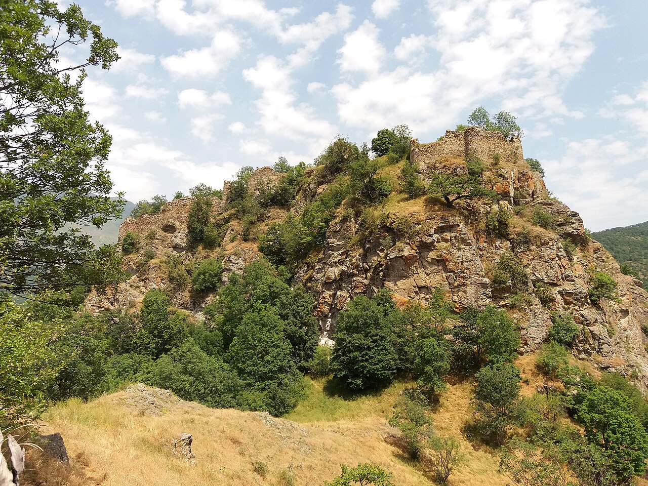
Handaberd (Armenian: Հանդաբերդ), also known as Lekh Castle (Azerbaijani: Lex qalası or Löh qalası) or Lev Castle, is a 9th-century fortress located in the Kalbajar District of Azerbaijan, near the villages of Lev and Knaravan, on the right bank of the Levçay River. It was built by Atrnerseh I, ruler of the Armenian Principality of Khachen, who resided there.
One of several castles in the highlands of Kalbajar, Handaberd was constructed over the Ayrım Gorge, on a high mountain ridge surrounded by thick forest, 600 metres (2,000 ft) from the right bank of the Levçay River flowing by Ganlykend village. Handaberd is first mentioned as "Handu berd" by the 10th century Armenian historian Movses Kaghankatvatsi, who wrote in his work History of the Country of Albania that the fortress was built by Prince Atrnerseh of Khachen in the second quarter of the 9th century. Atrnerseh, a member of a branch of the Siunia dynasty, ruled over an area approximately corresponding to the historical Armenian province of Artsakh. Handaberd was located in the Tsar province (also known as Upper Khachen) of the Principality of Khachen․ It served as Atrnerseh's residence as well as a prison for prisoners sentenced to death.
According to the inscription on one of the khachkars kept at Dadivank, a nearby Armenian monastery, from 1142 to 1182 Handaberd belonged to Hasan I Vakhtangyan, prince of Upper Khachen. Some time after the initial construction under Atrnerseh, the fortress was significantly expanded. Around 1250, the fortress is mentioned in the history written by the Armenian historian Kirakos Gandzaketsi. According to one legend, the fortress was repaired using funds sent by Levon I, King of Cilician Armenia, and called Levonaberd (see variations thereof below) in his honor.
Handaberd's inscriptions were studied by the French orientalist Marie-Félicité Brosset in the mid-19th century. Less than a kilometer to the east of the fortress is a medieval monastery complex bearing the same name, which has also been excavated.
The fortress has historically been referred to by various names and renderings, such as Lev (also the Armenian name for the Levçay River), Levaghala, Levkala, Levonaberd, Lohaberd, Handberd, and Handuberd.
The castle is surrounded by steep rocks and streams from three sides, and looks like a natural rock relief.
Text adapted from “Handaberd” on Wikipedia, CC BY-SA 4.0.
Handaberd ranks #5,190 of 9,079 worldwide in the atlas's castle fame ranking, and #27 of the 46 mapped in Azerbaijan. Founded c. 850, it is older than 94% of the atlas's dated landmarks — one of 88 atlas entries founded in the 9th century. The nearest day-trip guide is Ganja, 54 km away. See how Azerbaijan compares in the castle statistics.
View on the interactive castle map →