 Germany · 17th century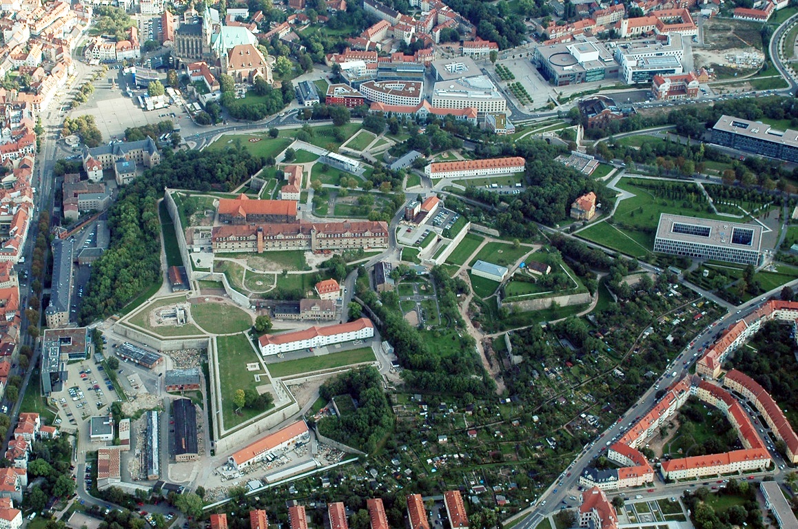
Petersberg Citadel (German: Zitadelle Petersberg) in Erfurt, central Germany, is one of the largest and best-preserved town fortresses in Europe. The citadel was built on Petersberg hill, in the north-western part of the old town centre from 1665, when Erfurt was governed by the Electorate of Mainz. It is surrounded by over two kilometres of stone walls and is 36 hectares in size.
Erfurt has also been ruled by Sweden, Prussia, Napoleon, the German Empire, the Nazis, and post-World War II Soviet occupying forces, and it was part of the German Democratic Republic (East Germany). All of these regimes used Petersberg Citadel and had an influence on its development. The baroque fortress was in military use until 1963. Since German reunification in 1990, the citadel has undergone significant restoration and it is now open to the public as a historic site. Its maze of underground passageways are also open to visitors and the fortress bakery (1832) is again in working order.
The fortress is also known by its French name, Citadelle Petersberg, as French troops were stationed there from 1806 to 1814, when Erfurt was under Napoleonic occupation. Napoleon visited Erfurt several times and the citadel was further developed during his rule, although parts of it were damaged in a battle in 1813.
The citadel was built on the site of a medieval Benedictine Monastery and the earliest parts of the complex date from the 12th century.
The former lower barracks (German:Untere Kaserne) building is now used to house and administer archives of the Stasi Records Agency.
The Cyriaksburg Citadel, is a smaller fortress to the south-west of Erfurt city centre, which dates from 1480. It is now the home of the German Horticulture Museum. During the Napoleonic period a hidden trench connecting the two citadels was built. The remains of this connection can still be seen at the Cyriaksburg Citadel today.
Text adapted from “Petersberg Citadel” on Wikipedia, CC BY-SA 4.0.
Petersberg Citadel ranks #1,956 of 9,035 worldwide in the atlas's castle fame ranking, and #155 of the 709 mapped in Germany. Founded 1665, it is older than 24% of the atlas's dated landmarks, one of 708 atlas entries founded in the 17th century. Its Wikipedia articles were opened 4,591 times in the last 60 days, more than 85% of the atlas. 12 more atlas landmarks stand within 25 km. It is one of the 38 landmarks on the atlas's regional map of Thuringia. See how Germany compares in the castle statistics.
View on the interactive castle map →