 England · 4th century BC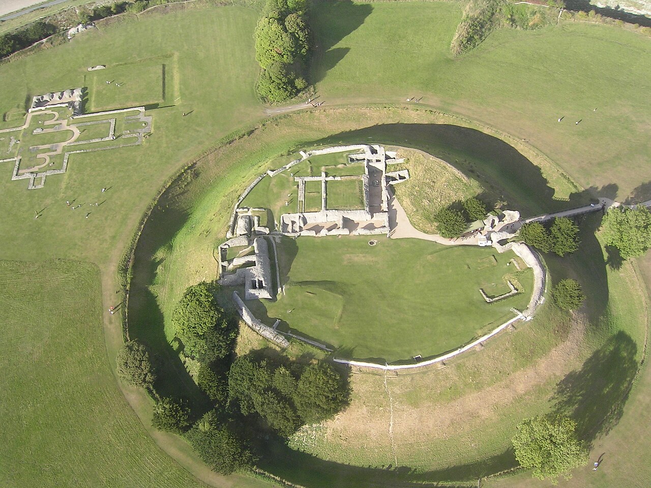
Old Sarum, in Wiltshire, South West England, is the ruined and deserted site of the earliest settlement of Salisbury. Situated on a hill about two miles (three kilometres) north of modern Salisbury near the A345 road, the settlement appears in some of the earliest records in the country. It is an English Heritage property and is open to the public.
The great stone circles of Stonehenge and Avebury are near Old Sarum and indications of prehistoric settlement at the site have been discovered from as early as 3000 BC. Around 400 BC, during the Iron Age, a hillfort was erected, controlling the intersection of two trade paths and the River Avon. The site continued to be occupied during the Roman period, when the paths were made into roads. The Saxons took the British fort in the 6th century and later used it as a stronghold against Vikings. The Normans constructed a motte and bailey castle, a stone curtain wall, and Old Sarum Cathedral. A royal palace was built within Old Sarum Castle for King Henry I and was subsequently used by Plantagenet monarchs.
This heyday of the settlement lasted for around 300 years until disputes between the Sheriff of Wiltshire, keeper of the castle, and the Bishop of Salisbury at the cathedral finally led to the removal of the church into the nearby plain. As New Salisbury grew up around the construction site for the new cathedral in the early 13th century, buildings at Old Sarum were dismantled for their stone and the old town dwindled. Its long-neglected castle was abandoned by Edward II in 1322 and sold by Henry VIII in 1514.
Although the settlement was effectively uninhabited by the 17th century, its landowners continued to have parliamentary representation into the 19th century, making it one of the most notorious of the rotten boroughs that existed before the Reform Act 1832. Old Sarum served as a pocket borough of the Pitt family.
Text adapted from “Old Sarum” on Wikipedia, CC BY-SA 4.0.
Old Sarum ranks #568 of 9,079 worldwide in the atlas's castle fame ranking, and #42 of the 360 mapped in England. Founded c. 400 BC, it is older than 99% of the atlas's dated landmarks — one of 15 atlas entries founded in the 4th century BC. Its Wikipedia articles were opened 13,183 times in the last 60 days, more than 96% of the atlas. 5 more atlas landmarks stand within 25 km. The nearest day-trip guide is Southampton, 35 km away. See how England compares in the castle statistics.
View on the interactive castle map →